It’s been a while since our last newsletter went out. Things have been somewhat busy on my end, and it isn’t easy to get these going. Help is very much needed and appreciated. We are looking for volunteers to help with the newsletter, articles, and more. Our newsletter is also now going to quarterly, albeit this one was a bit late.
Our Association breaks the state up into four regions. We’d like to put YOU in charge of one of the regions. You can be our regional contact or reporter. You can use the newsletter and website to help promote various events, businesses, and locations along Historic US 99.
Contact us if you have any questions, interested in writing for this newsletter, or giving a presentation for the Association. We’d love to hear from you!
Now onto 99 business. Winter has been a bit harsher lately, with heavy rains and snows along the route. The Ridge Route / Grapevine has been closed at times due to snow and mudslides. Lake Shasta rose quite a few feet over the course of a few days inundating long sections of historic highway. Rare avalanches were visible from I-10 in Beaumont Pass coming down from Mt San Jacinto. All this and we’re not even done yet. To this end, here are some tips for travel over The Grapevine / Ridge Route during winter.
Ridge Route / Grapevine Winter Travel Tips
Tejon Pass on February 25, 2023. Courtesy – Caltrans and Ft Tejon CHP
I-5 between Santa Clarita and the San Joaquin Valley over Tejon Pass is known as “The Grapevine” and formerly known as “The Ridge Route”. It is an important corridor in California and has been so since 1915. Travel over the route can be quite treacherous in winter due to both rain and snow. Mudslides, rockfalls, and ice can all wreak havoc on travel. Caltrans, CHP, and the County of Los Angeles work together to ensure safe travel over the route. Sometimes this can result in a full closure of the pass.
STATS:
Highest elevation – 4144′ at Tejon Pass
Normal Closure Points:
Southbound at Grapevine (Exit 215)
Northbound at Castaic – Lake Hughes Road (Exit 176B)
ALTERNATE ROUTES:
If the 5 is closed, alternate adjacent routes such as Lake Hughes Road are not advisable as they may be in worse condition or be heavily congested. Depending on closures, the best alternative to I-5 is via State 14 (Antelope Valley Freeway) and State 58 over Tehachapi Pass. In times of heavy snow, your only option may well be US 101 to State 46 in Paso Robles. Check with Caltrans and CHP prior to travel to make sure these roads are open.
SPECIAL NOTE:
The Old Ridge Route (Ridge Route Road) is never an alternate to I-5 under any conditions and is not suitable for heavy traffic nor is it open to through traffic.
To stay up-to-date on current conditions, we recommend the following sites:
Quickmap – Caltrans Traffic Map with CHP Incidents and Cameras
Be safe out there and always use caution during winter months when traveling the “Grapevine”.
Membership and Donations
We need your support for our efforts to get Historic Route signage placed in various cities and historic locations such as the Pine and Palm. You can do this by becoming a member, donating money, or by volunteering with our Association. We are a 501(c)3 non-profit corporation and your donations may be tax deductible. Why not help reduce your tax burden for 2023 / 2024 by donating prior? We can also use your help with some of our projects, website, and our newsletter. Having someone local to act as our ambassador or liaison would be of great help. Join now or renew and help us grow!
What is the Historic Highway 99 Association of California?
We started this Association in November 2020 to give Historic US Highway 99 in California a greater voice. So much has been lost over the years and we wanted to help preserve what we could. We have goals to get the roadway marked with Historic Route signs where possible, save sections of original paving, help revitalize businesses and towns along the route, and work to promote the highway however we can.
Those goals won’t be achieved overnight. They will take time and effort. Getting funding and permission to post signage takes a while. Each agency has different rules and methods. Funding comes from many sources, most of which is through donations and the generosity of the cities along the way. To date, we have had success with two cities, Madera and Calexico, with others on the way. Both cities have been very helpful, and we look forward to our continued success with other cities. If you’d like to help with signage in your city, let us know!
Saving sections of the original paving is another goal that isn’t easy but one that can be done. One of our recent projects has been to save a section of Roberts Road in the Calimesa area (HH99AC Region 4) which will be demolished in the near future. Thanks to the efforts of the City of Calimesa, letters from the Redlands Conservancy, and donations received by the Association, we will be able to save at least one of the remaining date stamps from the 1925 concrete. We have been in contact with the developers that own the land as well as the City of Calimesa to ensure this piece of history is preserved. The concrete isn’t particularly historically significant, but it is the last of its kind in the area. Saving it helps keep a bit of history alive.
Helping businesses and towns along the route is something that is more of a group effort. To help assist in achieving this goal, we started our “Highway 99 Adventures” pages where we highlight things to see along the route. Locations listed on the pages range from historic restaurants like the 134-year-old Saugus Cafe in Santa Clarita (HH99AC Region 4), lava tubes near Mt Shasta (HH99AC Region 1), underground gardens in Fresno (HH99AC Region 3), and even the State Capitol Building in Sacramento (HH99AC Region 2). We encourage all that use those pages to let people know where you found them. We also are looking for help with those pages in regard to locations, descriptions, and other content.
Our organization is small but growing. We can’t achieve our goals of preserving and promoting Historic US Highway 99 without your help. That help can come in many forms, such as donations or active involvement in our efforts. We have done a lot more than I had expected so far and there is much more that will happen. We are also looking for ideas of projects, fund raising efforts, website and newsletter content, and presentation ideas. Join our cause and help us grow further! Contact us for more information.
Membership and Donations
As we slowly ramp up our efforts to get Historic Route signage placed in various cities and historic locations such as the Pine and Palm, we need your support. You can do this by becoming a member, donating money, or by volunteering with our Association. We are a 501(c)3 non-profit corporation and your donations may be tax deductible. Why not help reduce your tax burden for 2023 by donating prior? We can also use your help with some of our projects, website, and our newsletter. Having someone local to act as our ambassador or liaison would be of great help. Join now or renew and help us grow!
We are working on an article about the town arches along Highway 99 and we need your help. We are seeking photos of the following arches:
Modesto
Lodi
Orland
The photos should show preferably the entire arch. If there is a dedication plaque nearby, we could use help with that as well.
December 2022 Presentation
We are still working on our final 2022 presentation. Instead of November, it will be held in early December. An announcement will be made soon with sign up information. It will also be a good time to discuss the future of the 99 Association and what you’d like to see get done. We look forward to seeing you, online, in December!
Featured Photo
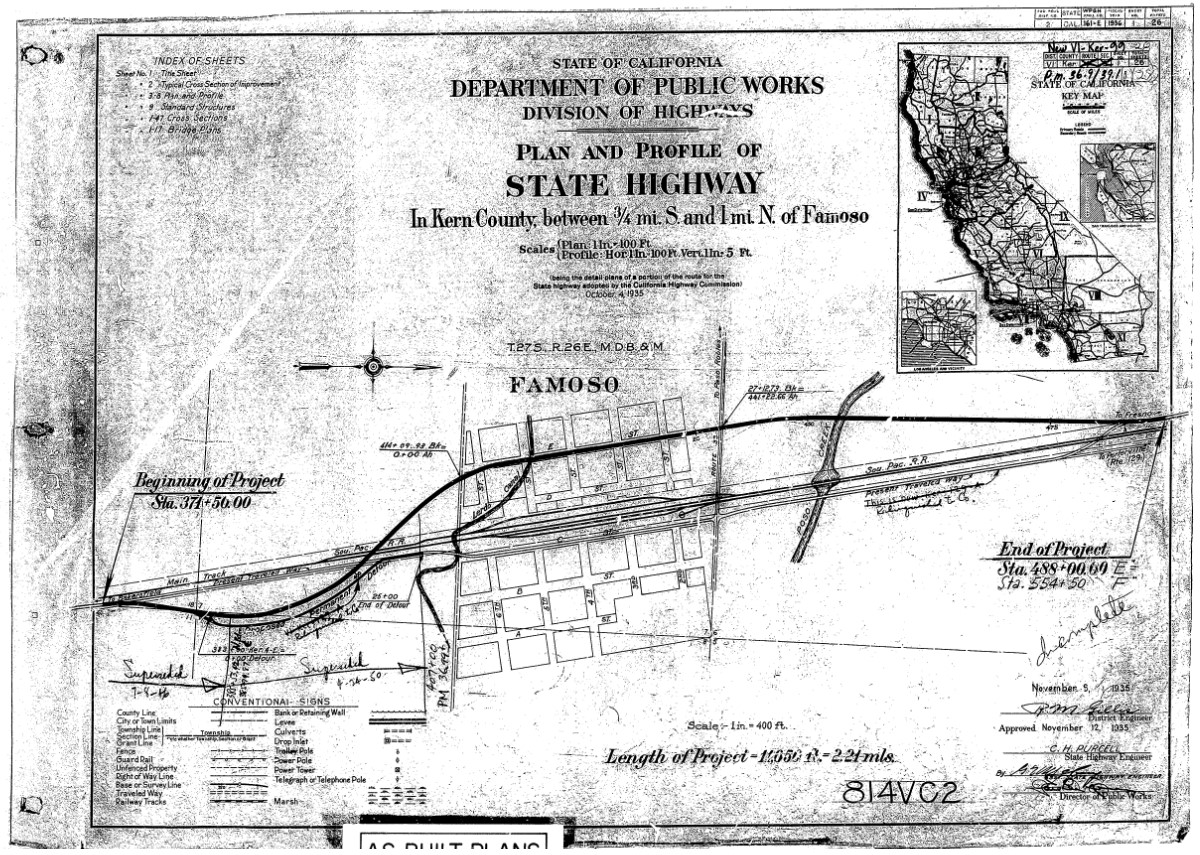
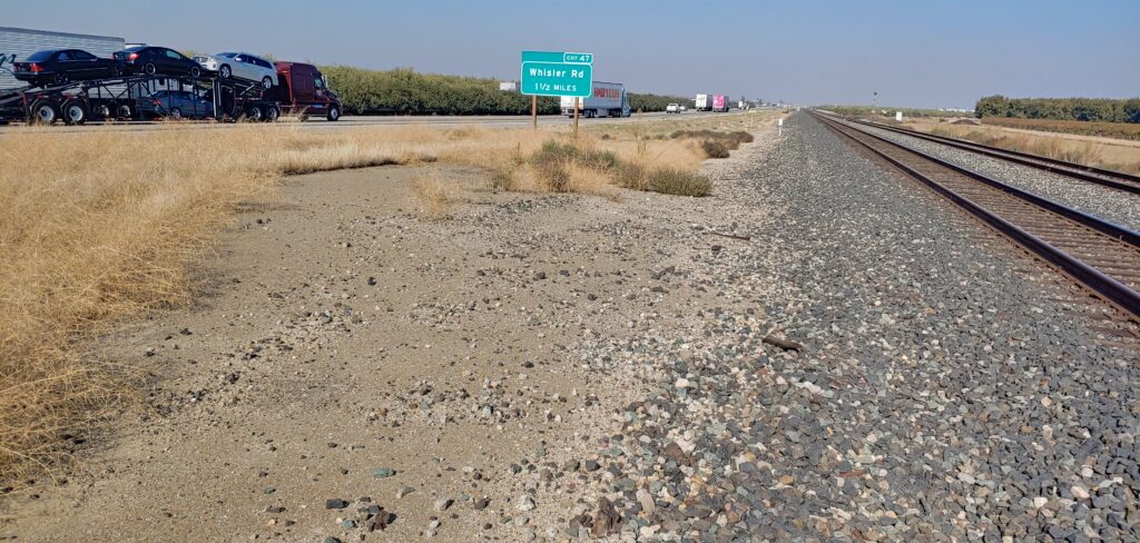
Division of Highways plans for the Famoso Underpass
In 1935, the California Division of Highways was in the middle of a large campaign to eliminate grade crossings along major routes. US 99 had quite a few in the Central Valley, mostly owing to its path following the Southern Pacific Railroad from Bakersfield to Stockton. One of these underpasses, at Famoso, necessitated the abandonment of a fairly long section of roadway. The underpass, completed in 1936, was itself was replaced with an overpass in 1970. Today, only traces remain of the original route. One surprising discovery was concrete paving still intact at the site of the old grade crossing just north of Famoso. It isn’t easy to access and, as it is along an active freeway, we do not recommend stopping.
Pyramid Rock and Cut along the Ridge Route Alternate
Surveying of the new “Ridge Route Alternate”, as it was to be called, began in 1928. The new alignment of the highway would diverge from the existing Ridge Route at Castaic and head north through the mountains via Violin Summit, Whitaker Summit, Piru Gorge, and Peace Valley rejoining the Ridge Route about one mile south of Gorman. From there, the new alignment would follow a much straighter path through Gorman and Tejon Pass. The old summit at Tejon Pass would be lowered from 4213’ to 4183’. The northern terminus of the “Ridge Route Alternate” was Lebec. The name Ridge Route Alternate came from the fact that the Division of Highways thought that people would still travel the original Ridge Route and use the new road as a faster way to travel. Their idea proved false as traffic completely disappeared from the Ridge Route as soon as the new road opened.
In late 1929, construction began on the new Ridge Route Alternate. The new alignment was built to the latest in highway standards. The new route was 9.6 miles shorter and had only 1/14 the curvature of the original Ridge Route. The Ridge Route Alternate was also much lower and more protected which made it less susceptible to fog, sleet, and snow. Instead of two ten-foot lanes on a 24-foot roadway like the Ridge Route had, the new roadway had three ten-foot lanes on a 38-foot roadway. This however only proved to be just as dangerous as two lanes as the center lane was a common passing lane, more commonly known as a “suicide” lane.
In Piru Gorge, massive cuts and fills had to be constructed. The largest cut, known as the Pyramid Cut, was 206 feet deep, 400 feet long, and required the removal of 230,000 cubic yards of material. This left a landmark along the highway that would outlast the highway itself, Pyramid Rock. In total, over 4.3 million cubic yards were excavated and over 30.2 million station yards of overhaul had to be moved. This is 77 times greater than what was moved in the construction of the Ridge Route back in 1915, just 18 years earlier.
Opening Ceremonies at the “Channel Change”
After more than four long years of work, the Ridge Route Alternate was finally opened to traffic on October 29, 1933. Thousands of people attended the ribbon cutting ceremony at the “Channel Change” in Piru Gorge, a change to Piru Creek that saved the cost of two bridges, which is near the halfway point along the route. Many cars were waiting at each end of the new route for the barriers to be removed, which were simultaneously removed at 10 am. Harry A. Hopkins, Chairman of the California Highway Commission, cut the ribbon and formally accepted the Ridge Route Alternate on behalf of the State of California in the name of Governor Rolph. One of the speakers at the ceremony, State Highway Commissioner Phillip Stanton stated that the completion of the Ridge Route Alternate was “the greatest blow to sectionalism in California since the construction of the original Ridge Route in 1915.” He said this because the new “high speed” route through the mountains would allow faster commerce and travel between Northern and Southern California.
Conversion of US 99 to an Expressway from a Three-Lane Highway
As traffic increased through the late 1930’s and the early 1940’s, the need to upgrade the Ridge Route Alternate became evident. Plans and contracts were ready as early as 1940 but World War II delayed those plans. The Collier-Burns Act of 1947 made more funds available from the gasoline tax to upgrade US 99 to an expressway through California. From 1947 to 1951, the Ridge Route Alternate would finally be widened from three lanes to a four-lane expressway. Work began on the first section, the bottom of Five Mile Grade at Castaic to Frenchman’s Flat, on March 13, 1947. The new, wider 78-foot roadway would consist of four twelve-foot lanes, a six-foot dividing strip, and two nine-foot shoulders. Where the divider had to be narrowed to four feet, raised concrete bars were used in the median to separate each direction of travel. The center divider was at its widest at Big Oak Flat, where an unpaved center dividing strip thirty-six feet wide was built.
Instead of concrete, asphalt was used in the paving of the roadway. The grade and curvature were changed just enough so that the original concrete could not be used. It was paved over in some places and completely torn up in others. There are many places where the original concrete is still visible and is usually found about one to two feet below the level of the current roadway. Construction was finally completed June 9, 1948 on Five Mile Grade, February 24, 1949 on the segment from Violin Summit to Whitaker Summit, September 1, 1948 on the segment from Whitaker Summit to Frenchman’s Flat. Widening work was completed through Peace Valley from Los Alamos Creek to just south of the junction of State Highway 138 on December 8, 1949.
By 1951, almost all of US 99 through the mountains was a four-lane divided expressway. Only three segments remained as a three-lane highway – 5.3 miles in Piru Gorge, 11 miles over Tejon Pass, and 5.1 miles in Castaic. Piru Gorge would be the most expensive and most difficult segment to widen. This section extends from Frenchman’s Flat north to the old Oak Flat Maintenance Station. More than 500,000 station yards were moved in the widening of the Piru Gorge segment. As a part of this project, the two bridges at Pyramid Rock were eliminated to save on costs. Instead of widening the bridges, they were removed and replaced with fill as Piru Creek was realigned through the widened Pyramid Cut. All but three miles of that expressway are under Pyramid Lake.
Even with these improvements, fatality rates along Five Mile Grade due to runaway trucks made a runaway truck ramp necessary. It was constructed about 3.5 miles south of Violin Summit and was opened in August 1956. It would be used many times in its 14-year span. The escape ramp was used for the last time in Mid-January 1970 just before the freeway was completed.
September 2022 Meeting and Presentation
Join us via Zoom on Tuesday, September 13, 2022 at 6 pm for a presentation on the Ridge Route Alternate between Castaic and Tejon Pass by Michael F Ballard. To register for the meeting:
I would like to welcome the City of Redlands to our Highway 99 Association. The City of Redlands is our first major sponsor, and we look forward to seeing more in the future. Redlands will also be the first city in San Bernardino County to have Historic US Highway 99 signs posted along its segment. Thanks to their generous donation and application, we can make sure US Highway 99 remains an important part of California history. We hope other cities and organizations follow their lead in the near future.
Remember, When You’re Through Getting Your Kicks on Route 66, Come Wine and Dine on Route 99! There are a lot of good places to do both in Redlands along 99. Come check them out and tell them the Historic Highway 99 Association of California sent you!
The Helen and Joe Chew Foundation, which gave a wonderful presentation in May on the history of the Chinese culture in Red Bluff is looking to raise funds for their cause. If you’d like more information and would like to help, we recommend checking out their website. You can also use the links below to directly contribute. I personally donated $50 toward their Historic Chinatown Signage project. They are a wonderful group with a great cause that needs your support. You can also get a special tour of the area, which is another Highway 99 Adventure, through your membership. Contact us for more details about that benefit.
As we slowly ramp up our efforts to get Historic Route signage placed in various cities and historic locations such as the Pine and Palm, we need your support. You can do this by becoming a member, donating money, or by volunteering with our Association. We are a 501(c)3 non-profit corporation and your donations may be tax deductible. Why not help reduce your tax burden for 2023 by donating prior? We can also use your help with some of our projects, website, and our newsletter. Having someone local to act as our ambassador or liaison would be of great help. We are also working out how to handle renewals for existing members. Initially, we had planned to have all memberships expire at a specific time. At this time, we are looking to have memberships expire at the end of the month initially obtained. Join now and help us grow!
We are working on an article about the town arches along Highway 99 and we need your help. We are seeking photos of the following arches:
Modesto
Lodi
Orland
The photos should show preferably the entire arch. If there is a dedication plaque nearby, we could use help with that as well.
Featured Photo
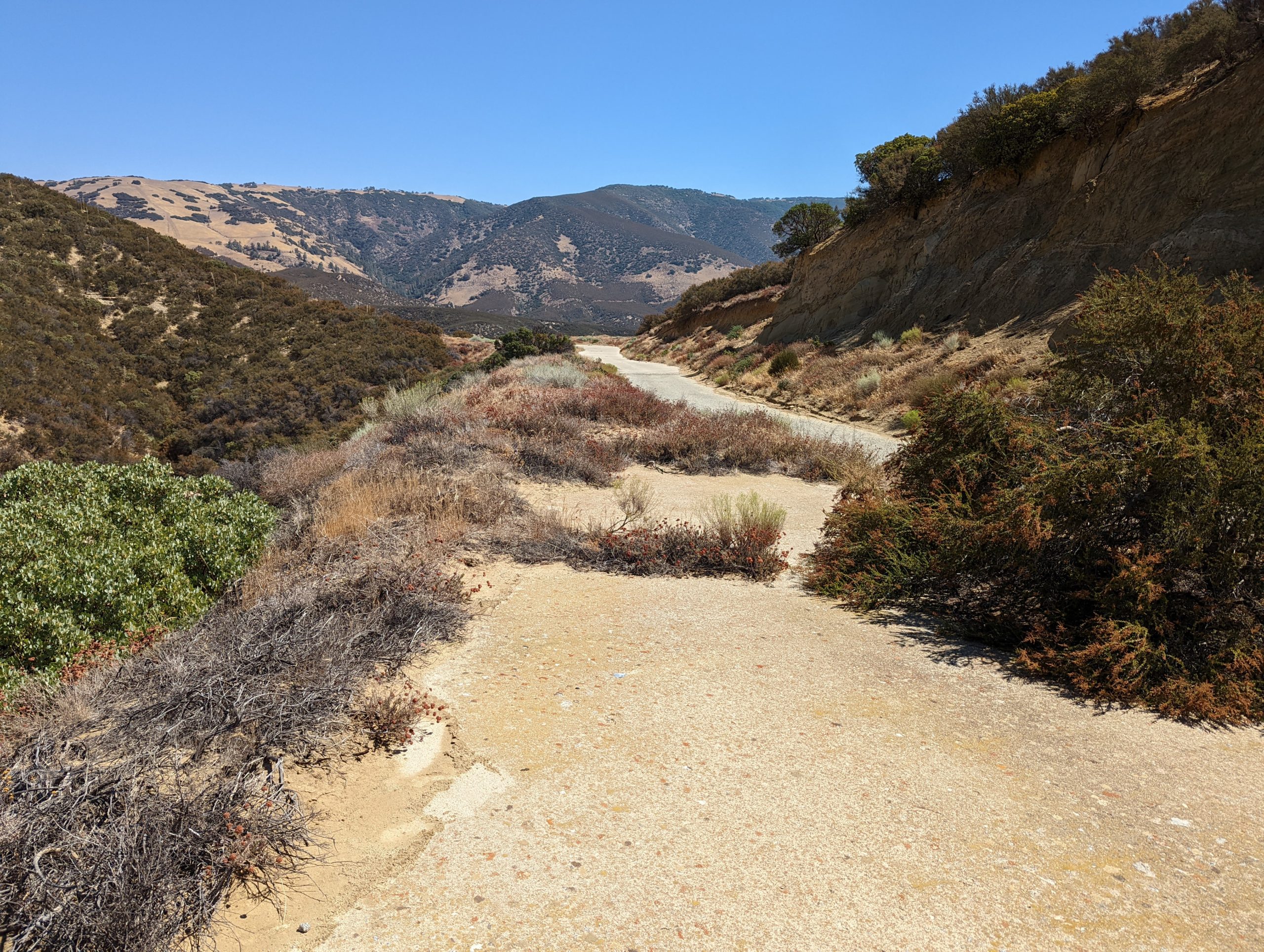
Abandoned section of the Historic Ridge Route near the Tumble Inn site
The Historic 1915 Ridge Route has seen quite a bit of changes since it was first constructed. Among those are the many “curve corrections” which were an effort to reduce the number of sharp curves along the roadway in the mid 1920’s. This particular location was bypassed about 1925, making it nearly 100 years since traffic last passed over it.
Memories of US Route 99 Red Bluff’s Chinatown by Jessica Casas
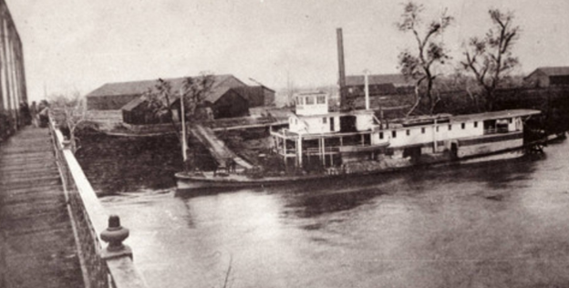
After gold was discovered in Coloma in 1848, thousands of people including Chinese arrived in California to seek work in the mining industry. Red Bluff was the furthest point north and the last ferry stop on the steamboat. The ferry stop would eventually create Pine Street with the first crossroad as High Street (currently known as Rio Street) and just one block further west would become Main Street or the old U.S, Route 99(W).
Logically, when the Chinese arrived in Red Bluff they took the boat as far north as possible in order to reach the “Gold Mountain” (金山 or “Gam Saan” in Cantonese). In China, they were told by the many companies soliciting laborers for work to “go abroad” so that one could strike it rich by finding gold in California and use their riches to improve their village, help fund educational institutions, obtain land expansion projects, etc. Since their early arrival in what is now known as Red Bluff’s Historic District, the Chinese were segregated to live on High Street beginning on Pine Street and ending on Hickory Street. The area on record was called “Chinatown”. What we know as Central Business Districts today, were former Chinatowns in most cities and former U.S. Route 99.
The truth is Chinatown was prosperous. It thrived because it was strategically located adjacent (one block south of Pine Street) to the railroad tracks where Sierra Flume and Lumber Company would fill carloads of logs into the Red Bluff railroad yard. The railroads offered a variety of jobs whether it was working on the expansion of the rail, seasonal farming jobs, rock walls or other season work.
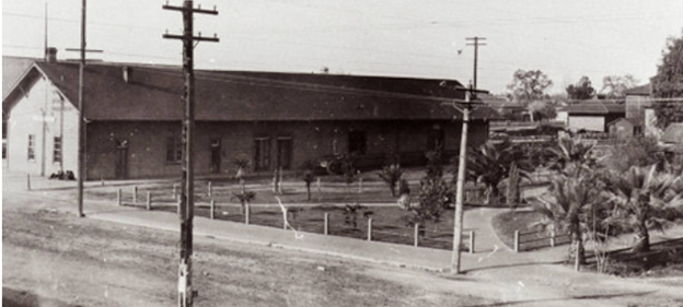
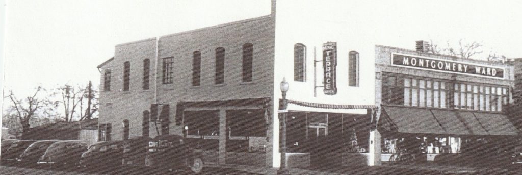
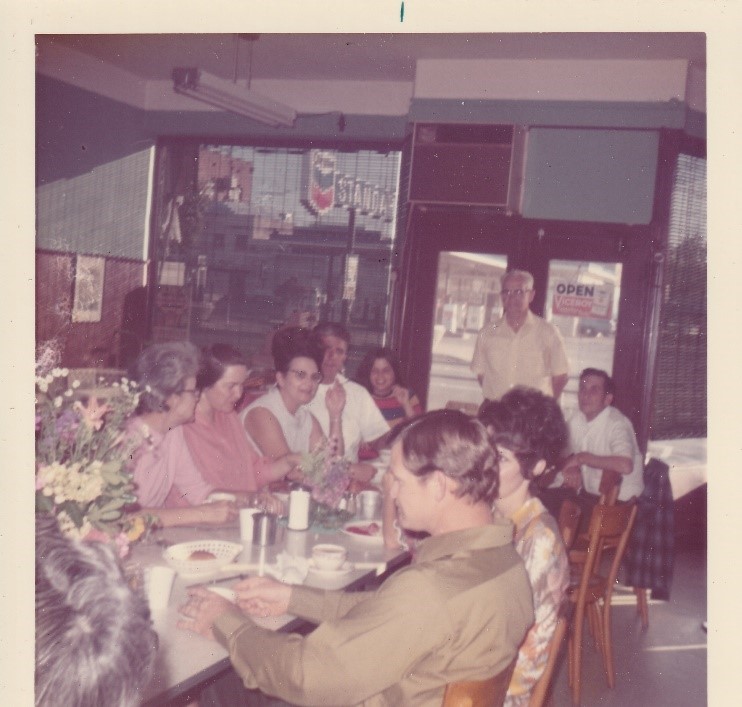
When the railroad was decommissioned, it became the old U.S. Route 99(E), but still adjacent to Chinatown. Although, Chinatown was located on High Street, it was just one block west of Main Street which meant it was close to U.S. Route 99(W). For the Chew family who originally came to Red Bluff in 1865-1870 (officially settled in 1888) the creation of U.S. Route 99(W) and 99(E) would create a smart business endeavor for them. So as the story goes, in 1949 the family (including children) pooled their savings together from the pinball machine at their first restaurant, California Café, and made a down payment on a larger property located at 860 Main Street and Hickory. It would become the popular restaurant, Ming Terrace. For the first time, the Chew family would serve Chinese American cuisines instead of American comfort food.
It would take another year of hard sweat and scrimping by to actually open the restaurant in 1949. Youngest siblings, Joe and Nettie Chew recalled that a friend, Harry On from Yreka, helped them buy a cash registered and later a car. The Red Bluff Daily News noted that “dishes of ancient China as well as American dishes will be served in a modern setting to progressive Red Bluff… The restaurant has paneled booths with chrome finish on tables and chairs, special embroidered painting imported from China and Ming trees made by Chinese craftsman in San Francisco.” Red Bluff Daily News circa August 30, 1949. Nettie and Julia Chew reminisce fondly that at the grand opening of Ming Terrace they wore their colorful Chinese “cheongsam” dresses to greet and welcome the customers to the new restaurant. With a new and larger business to develop, all members of the family worked long hours daily and then climbed upstairs from the restaurant to enter their living and sleeping quarters. Still common today in China, the alleyway was vibrant. In the rear of the restaurant, there was an alleyway which served as a
key corridor into Red Bluff’s Chinatown. So, the young children were tasked with gathering the chickens and the vegetables from the Chew garden, they would then bring them through the backdoor straight to the restaurant kitchen. What we call “Farm to Table”! The Chew family was well regarded mostly for their humility. During the Great Depression, eldest sibling, Dick Chew fed those hungry on an honor system. He just couldn’t bear to see folks go hungry. For the Ming Terrace, this tradition continued and if you were an out-of-towner stopping for gas, Chevron would send you to the Ming Terrace for a free “cup of Joe”! Business grew strong into the 1950s through the 1970’s.
However, the construction of I-5 to replace U.S. Route 99(E) and 99(W) would change everything. Joe was a naturally gifted man in finance and accounting even though he was the youngest sibling. He had the wisdom to realize that I5 would deter business away from Red Bluff’s Main Street hence, potentially becoming detrimental to the family business. Like many untold Chinatown stories, the construction of I5 would forever eliminate their once thriving neighborhoods ending the legacy of Red Bluff’s Chinatown in 1973 when the Ming Terrace closed. It was the last residence and business to operate in the long-lost historic Chinatown of Red Bluff, CA.
Although, a Chinatown no longer exists today, Red Bluff’s Chinese Pioneers now have descendants who have not only made America their home for generations but prospered due to the cross-pollination of ideas, ingenuity, contributions to science, healthcare, public service, business, and the arts, paving the way for the advancement of all Americans today. The newest transplants of Chinese families in Red Bluff have added to the town’s growth and diversity in numerous ways contributing to businesses and the labor market. In memory of the original Chinese Pioneers and in tribute to the honorable work of today’s Asian community in Red Bluff, the Helen and Joe Chew Foundation has submitted an application to name the alleyway adjacent to Main Street (where the old U.S. Route 99 once ran through), to “Historic Chinatown Alley”. We would like to thank you old U.S. Route 99 from the bottom of our hearts, you have made our Chinatown flourish and you are forever in our memories.
For further information, we strongly recommend heading to their website at Red Bluff Chew.
May Presentation
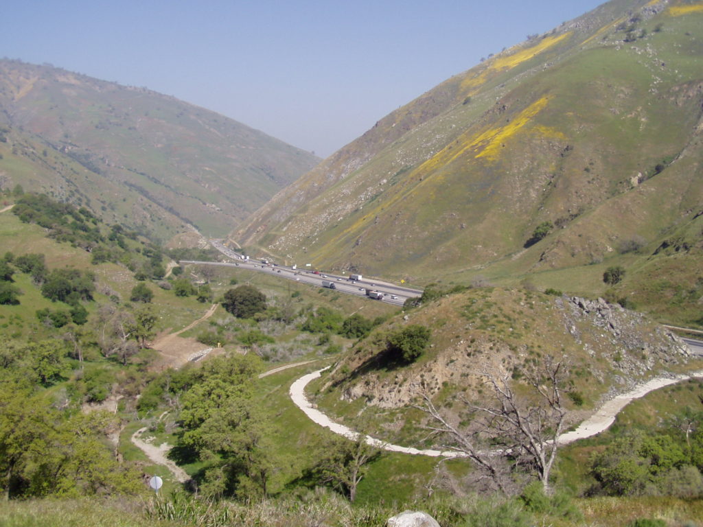
Deadman’s Curve, Grapevine Canyon. Courtesy – Michael F Ballard
Join us on Tuesday, May 10, 2022 at 6 pm for a presentation via Zoom on the Historic Ridge Route by Michael F Ballard. The road will be covered from Castaic to Gorman. Learn about the current status of the roadway and the Ridge Route Preservation Organization that is working to reopen the roadway.
Please register for the presentation using the link below:
On the evening of Thursday, April 14, I gave a presentation on the history of US 99 through the San Gorgonio Pass to the San Gorgonio Pass Historical Society at the Cherry Valley Grange. This was the first time I had given a presentation in person in a very long time. To be honest, I was quite nervous but was confident it would go well in the long run. The event was well attended with a total of 68 people, far more than I had expected. It was also their second highest attendance. I want to thank the Historical Society and the attendees for allowing me the opportunity to give the presentation. I had a really great time and had a lot of fun.
Membership and Donations
As we slowly ramp up our efforts to get Historic Route signage placed in various cities and historic locations such as the Pine and Palm, we need your support. You can do this by becoming a member, donating money, or by volunteering with our Association. We are a 501(c)3 non-profit corporation and your donations may be tax deductible. Why not help reduce your tax burden for 2023 by donating prior? We can also use your help with some of our projects, website, and our newsletter. Having someone local to act as our ambassador or liaison would be of great help. We are also working out how to handle renewals for existing members. Initially, we had planned to have all memberships expire at a specific time. At this time, we are looking to have memberships expire at the end of the month initially obtained. Join now and help us grow!
We do wish to thank all those that have donated and become members thus far. Our most recent project in Madera couldn’t have happened without your support!
Featured Photo
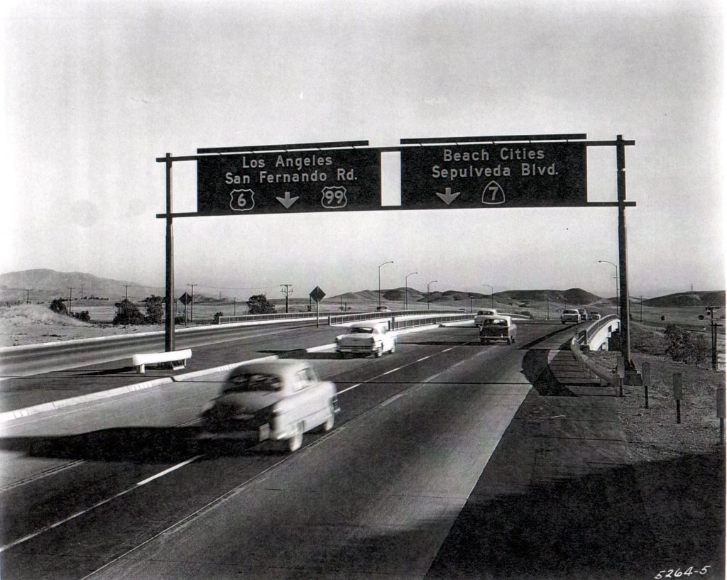
Looking south at the San Fernando OH (53-0730) on December 28, 1956. Courtesy – Caltrans
In 1955, the first section of the Golden State Freeway was completed in Newhall Pass. It stretched from Tunnel Station (Junction US 6) to Sepulveda Blvd (Junction State 7). Heading south into the San Fernando Valley, a choice had to be made. Follow US 6 / 99 to Los Angeles or go to the westside and follow Sepulveda Blvd. The photo above shows the split where it crosses over San Fernando Road (old US 99). You can also see how the striping was modified, likely to give more room and reduce the chance of someone cutting across three lanes to stay on 99. Today, this same split is a little further south, where I-5 and I-405 meet. The same choices are to be made today. Go to the city or go to the beach.
A Brief History of Grapevine Canyon in Kern County and US Highway 99 – Part 1 by Michael F Ballard
1914 – 1933
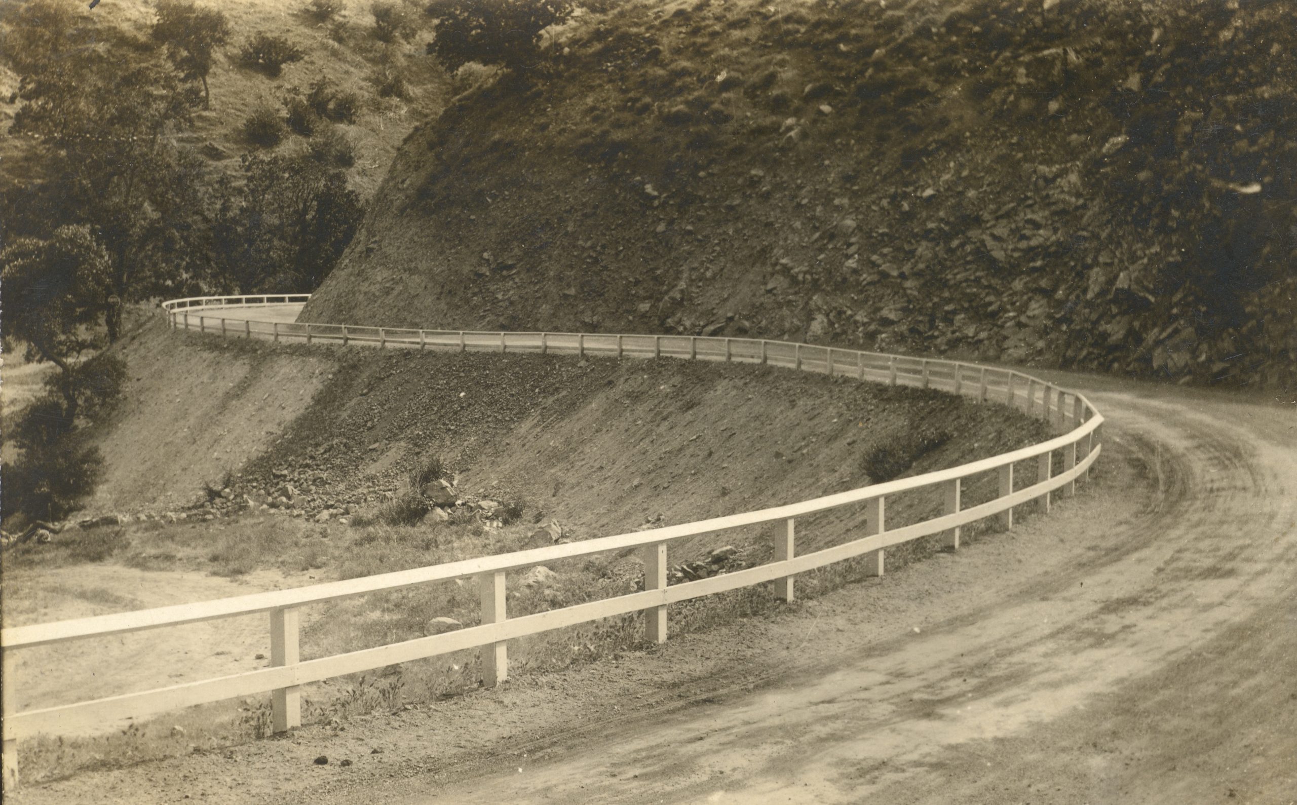
Dead Man’s Curve in 1914, just after construction
Grapevine Canyon, or Canada De Las Uvas, was named for the wild grapes that grow on its slopes by Spaniards in the 1700′s. The town of Grapevine has been a major stop along this highway ever since the Ridge Route was built in 1914. This first alignment was one of the most torturous sections of US 99 in Southern California. It had more than a few very sharp curves, some of which ended up with names such as “The Loop” and “Deadman’s Curve”. Both of those curves still exist today, though partially removed and cutoff from the new roadways. In 1915, the grade was oiled creating a more solid, albeit temporary, roadway. Grapevine Grade received its first concrete pavement in 1919, a “full” 20 foot slab with curbing and little in the way of a shoulder. The original location of the “town” of Grapevine was at the bottom of the grade. It consisted of a motel, store, gas station, and restaurant. In 1926, work commenced to “daylight” some of the sharper curves along the grade, which increased sight-distance and did help to reduce collisions. It didn’t, however, reduce the curvature of the road.
1933 – 1943
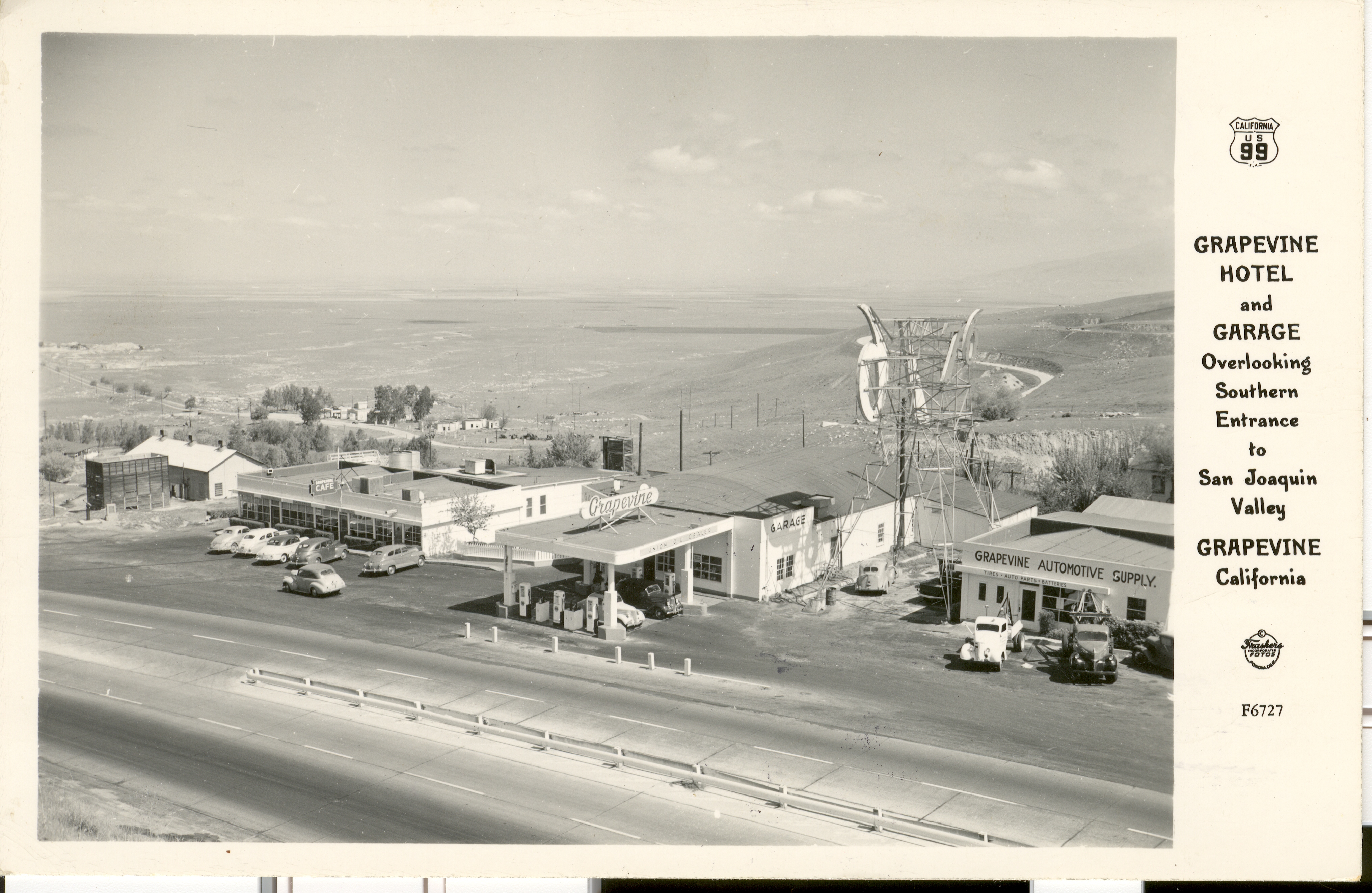
Postcard showing the Grapevine Cafe and gas station
In 1933, a new alignment of US 99 was built. It ran along the current southbound lanes of I-5 for most of the grade. Deadman’s Curve and the Loop were eliminated at that time. When the concrete was first poured, only two lanes were built. About a year later, the third lane was added making the center lane the passing lane. Since the original location of Grapevine was bypassed, it was partially relocated onto the new grade, this time in the canyon. While it was rather conveniently located, it did suffer from one fatal flaw. It was near the bottom of a very long, steep grade, and on the outside of a curve. As a result, runaway trucks smashed through on a few occasions.
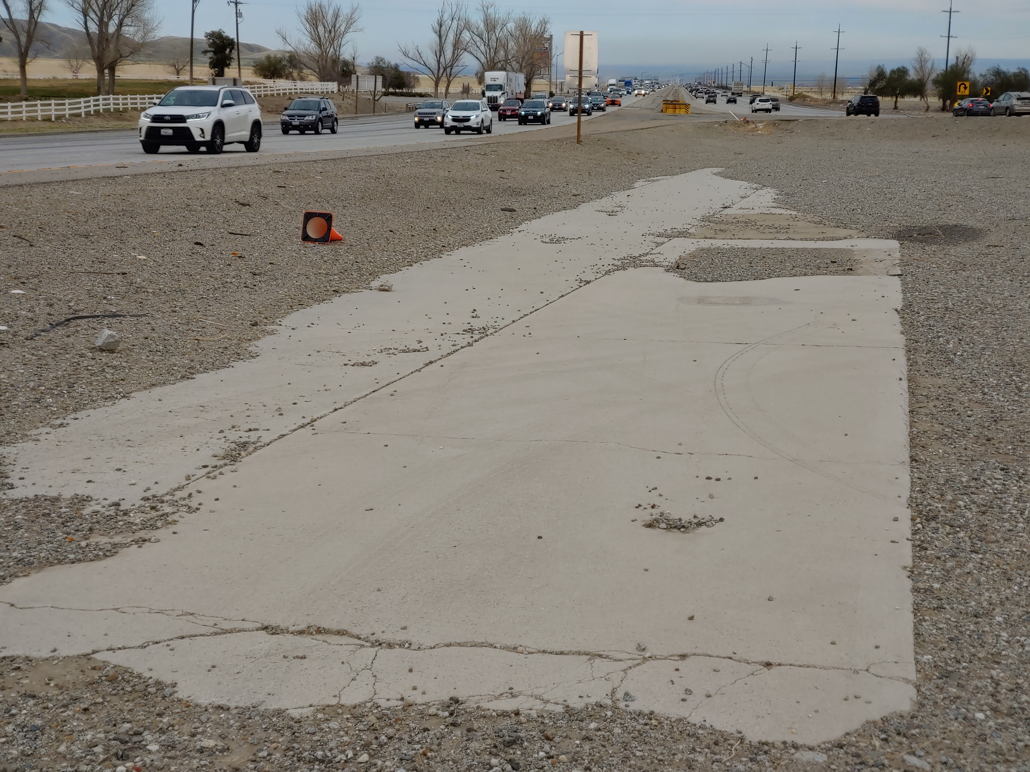
1932 / 1933 concrete in the median of I-5 at Grapevine. Courtesy Michael F Ballard
Shown above, a small section of concrete is visible adjacent to the southbound lanes of I-5. A small color difference can be noticed between the two lanes that are visible. This difference is due to age. The lanes to the left were constructed in 1932 when Grapevine Grade was realigned, bypassing the original 1914 Ridge Route grade. This was built as two lanes as a temporary measure to expedite the opening of the new route. Right after it was opened, a third lane was added, the lane on the right, creating a three-lane roadway with a common passing lane in the center, or “suicide lane”. This condition persisted until 1943 when the road was widened yet again to four lanes. In 1958 – 1960, these lanes were bypassed by the current southbound lanes of I-5. Today, they remain as one of the last remnants of the 1932-1958 version of Grapevine Grade.
To be continued in our May / June 2022 Newsletter
March 2022 Presentation
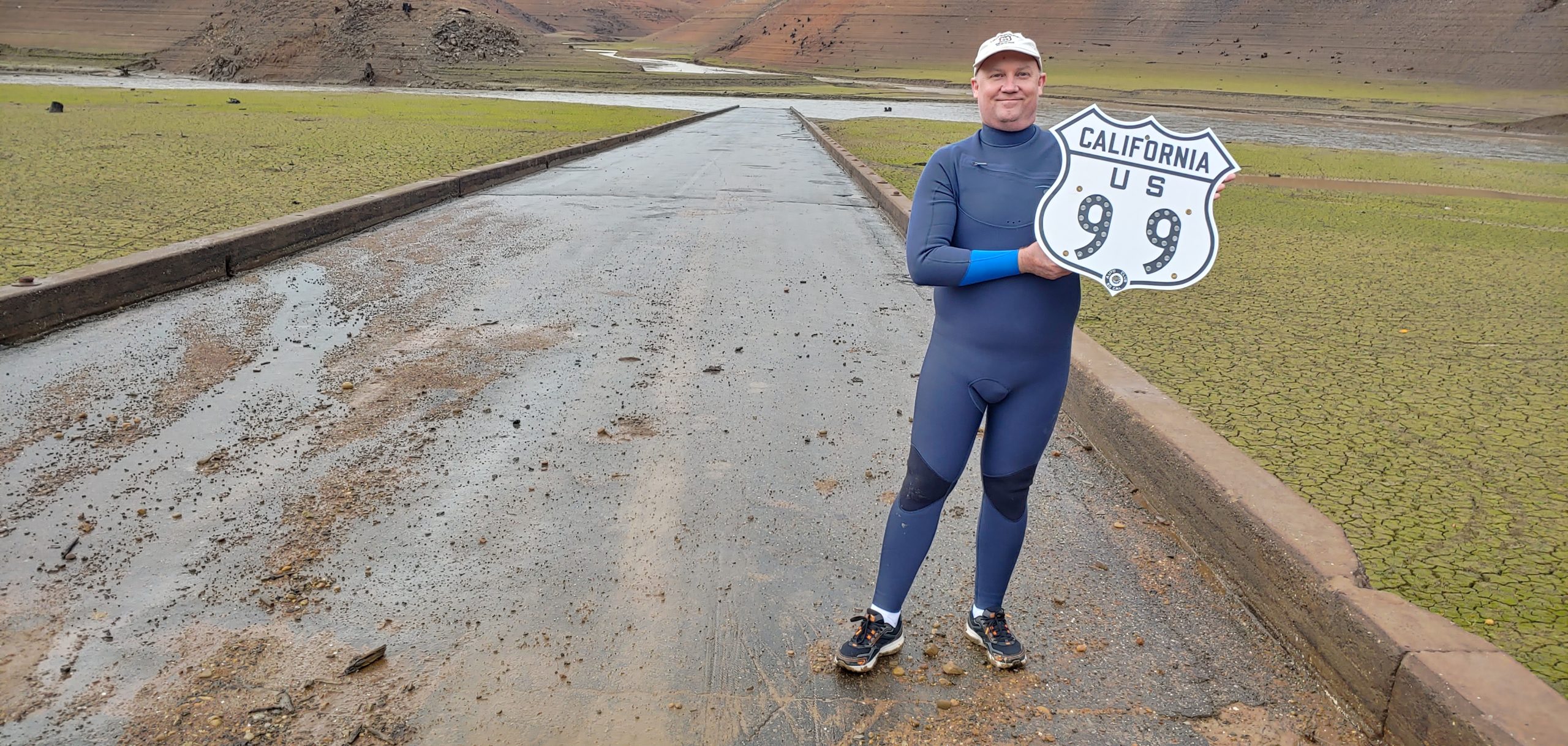
At the Pollock Bridge in November 2021, then fully exposed. Courtesy – Michael F Ballard
Join us on Tuesday, March 8, at 6pm for a presentation on Lake Shasta and Environs by Michael Ballard. We will be sharing photographs from our November 2021 trip to the Lake Shasta area showing the low lake level as well as some additional photos of the surrounding area.
Please register for the presentation using the link below:
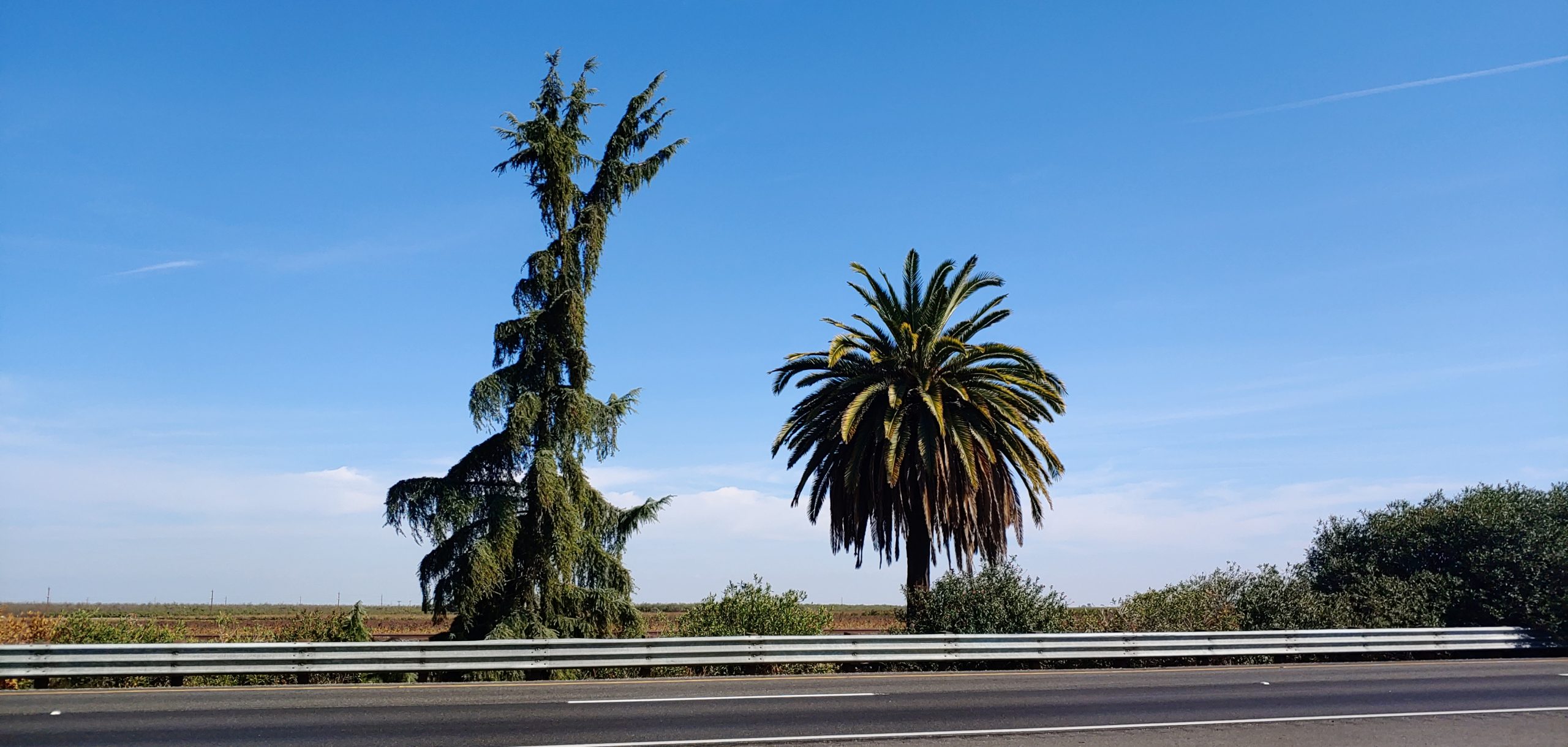
Just south of Madera, 1.75 miles south of Ave 12, and 2.1 miles north of Ave 9 (or more specifically at 06-MAD-99-05.7), there lies a pine tree and a palm tree in the median of Highway 99. It has been there since the 1920’s and marks the former halfway point in California. The Palm Tree, a Canary Island Date Palm, represents Southern California and the Pine Tree, a Deodor Cedar, represents Northern California. In 2005, the pine tree fell down but was replaced by Caltrans in 2007 as this is a somewhat historic marker.
We, the Historic Highway 99 Association of California, intend to have signs placed in both directions at this location to mark the historic site. While it might not exactly be the “halfway” point in California, it is close enough and has been there since the 1920’s. We are looking to work with local agencies such as the County of Madera, Caltrans District 6, City of Madera, and others to gain support and assistance with this effort. We already have a design for the sign and cost estimates for its fabrication.
If you would like to be involved in this project (03-MAD21002), let us know! We can use help either through donations of labor or money. Any donations are likely tax-deductible as we are a 501c3 organization.
99 Alert – William S Hart Park in Santa Clarita
One of our members and local historians, Evan Decker of Santa Clarita, has brought to our attention something concerning a park in his area. William S Hart Park, the former home of the silent film actor, is currently a park owned and administered by Los Angeles County. This arrangement is due to the stipulations in the will of William S Hart, who deeded the land and associated structures in perpetuity to Los Angeles County.
The City of Santa Clarita, in an effort spearheaded by the current major Laureen Weste is looking to take over the park. By itself, it would seem like a “home rule” sort of issue, which can be a good thing. However, the City of Santa Clarita has a poor track record of preserving history and keeping it safe. This has been shown with the “disneyfication” of the central business district of Newhall, among other things. We feel this change would be a detriment to the historical value of Hart Park and would not be to its best interest.
If you would like to help with preventing the City of Santa Clarita from taking over William S Hart Park, Even Decker has set up an online petition to sign. He also strongly recommends contacting the office of Los Angeles County Supervisor Kathryn Barger and tell her you’re against this project.
We, the Historic Highway 99 Association of California, only want to help preserve and protect the history along Highway 99. Newhall was one of the towns along the earliest alignment of US 99. Hart Park represents a part of that early history.
Please sign the petition created by Evan Decker to tell the City of Santa Clarita that you want the park kept as-is and not in City hands.
Membership and Donations
As we slowly ramp up our efforts to get Historic Route signage placed in various cities and historic locations such as the Pine and Palm, we need your support. You can do this by becoming a member, donating money, or by volunteering with our Association. We are a 501(c)3 non-profit corporation and your donations may be tax deductible. Why not help reduce your tax burden for 2023 by donating prior? We can also use your help with some of our projects, website, and our newsletter. Having someone local to act as our ambassador or liaison would be of great help. We are also working out how to handle renewals for existing members. Initially, we had planned to have all memberships expire at a specific time. At this time, we are looking to have memberships expire at the end of the month initially obtained. We will be sending out a letter to our current members to explain how to renew. Join now and help us grow!
We do wish to thank all those that have donated and become members thus far. Our most recent project in Madera couldn’t have happened without your support!
Featured Photo
Hawkbryn Ave in Newhall, CA. Courtesy – Michael F Ballard
Recently, a section of 1930 US 99 was rediscovered in the Santa Clarita Valley. Thought lost since the 1960’s, a small section of the 1930 “Newhall Alternate” was found along a residential street south of Lyons Avenue. This roadway, at least a portion of it, represents one of the few remaining sections of the 1930 roadway north of Calgrove Blvd. In 1967, I-5 was constructed here and the new road was shifted a little to the west, leaving this road, now known as Hawkbryn Ave, as a frontage road. Traces of the 1930’s concrete can still be detected today. This section was discovered using comparisons between aerial photography and the construction plans from 1949 and 1967.
Despite having traversed this area many times, I never thought to look here. Always keep your eyes open, for you never know what you might find.