I apologize for the absence of a newsletter this last cycle. I’ve been busy with moving and remodeling a house so have been unable to work on much things related to the Association. Your continued support is greatly appreciated. We have a few projects in the works still, including signing the Pine and Palm, posting new Historic Route 99 signs in Redlands, and saving the 1925 concrete date stamps in Calimesa. We can use your help in many ways including helping with our newsletter and outreach. Got something fun to talk about along Highway 99? Contact us for more information!
Join us via Zoom on Tuesday, September 13, 2022 at 6 pm for a presentation on the Ridge Route Alternate between Castaic and Tejon Pass by Michael F Ballard. To register for the meeting:
Deadman’s Curve, Grapevine Canyon. Courtesy – Michael F Ballard
Join us on Tuesday, May 10, 2022 at 6 pm for a presentation on the Historic Ridge Route by Michael F Ballard. The road will be covered from Castaic to Gorman. Learn about the current status of the roadway and the Ridge Route Preservation Organization that is working to reopen the roadway.
Please register for the presentation using the link below:
A Brief History of Grapevine Canyon in Kern County and US Highway 99 – Part 1 by Michael F Ballard
1914 – 1933
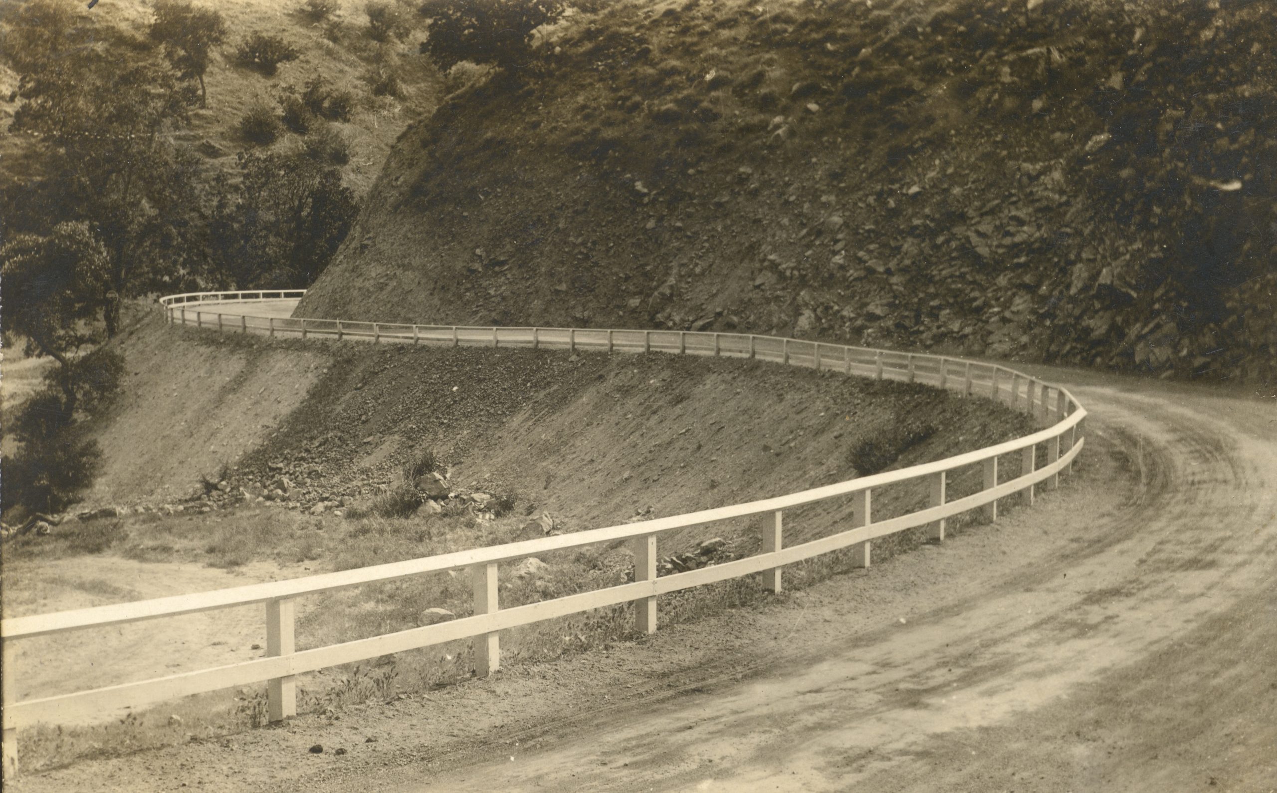
Dead Man’s Curve in 1914, just after construction
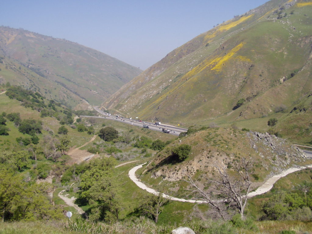
Grapevine Canyon, or Canada De Las Uvas, was named for the wild grapes that grow on its slopes by Spaniards in the 1700′s. The town of Grapevine has been a major stop along this highway ever since the Ridge Route was built in 1914. This first alignment was one of the most torturous sections of US 99 in Southern California. It had more than a few very sharp curves, some of which ended up with names such as “The Loop” and “Deadman’s Curve”. Both of those curves still exist today, though partially removed and cutoff from the new roadways. In 1915, the grade was oiled creating a more solid, albeit temporary, roadway. Grapevine Grade received its first concrete pavement in 1919, a “full” 20 foot slab with curbing and little in the way of a shoulder. The original location of the “town” of Grapevine was at the bottom of the grade. It consisted of a motel, store, gas station, and restaurant. In 1926, work commenced to “daylight” some of the sharper curves along the grade, which increased sight-distance and did help to reduce collisions. It didn’t, however, reduce the curvature of the road.
1933 – 1943
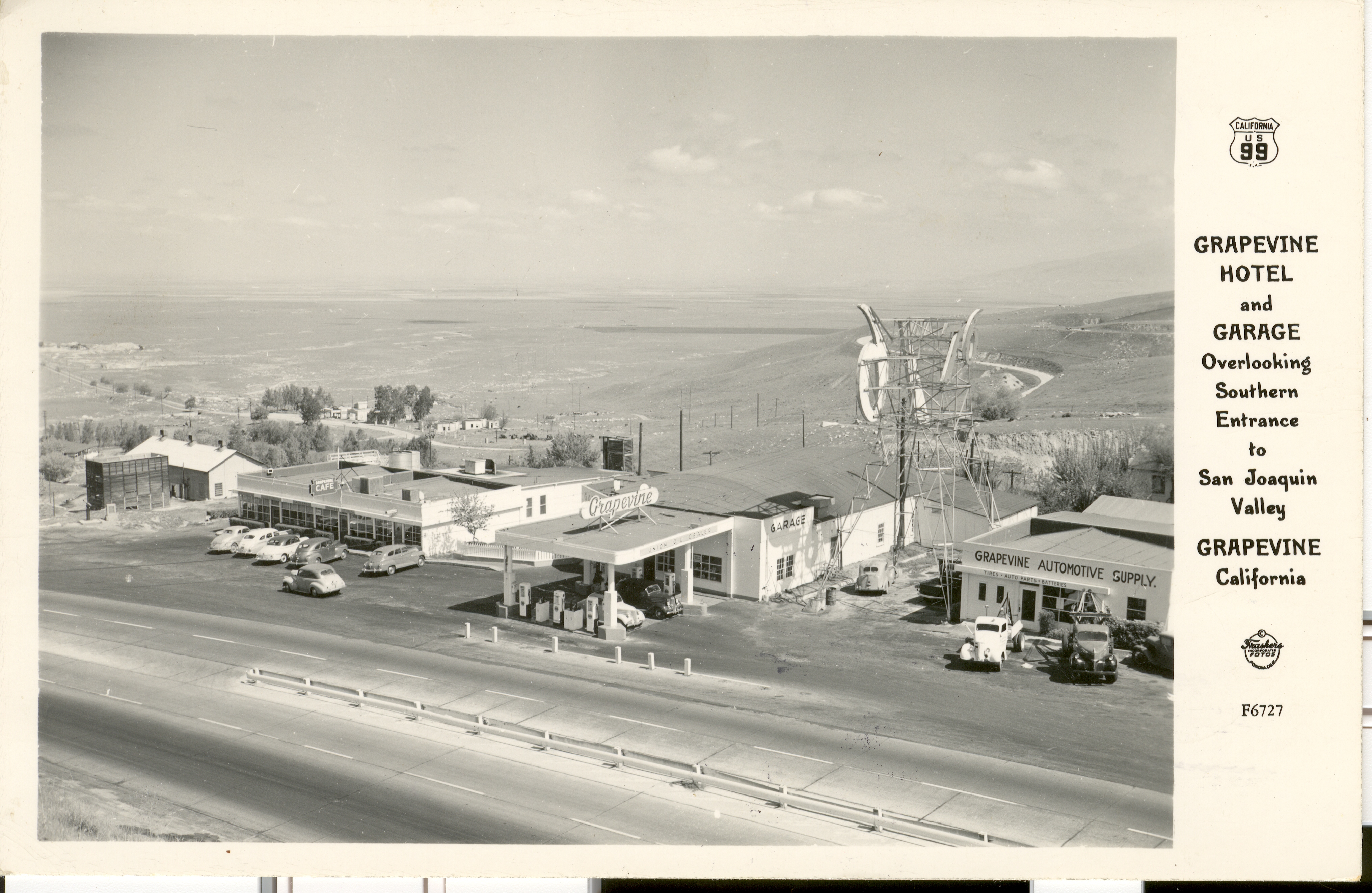
Postcard showing the Grapevine Cafe and gas station
In 1933, a new alignment of US 99 was built. It ran along the current southbound lanes of I-5 for most of the grade. Deadman’s Curve and the Loop were eliminated at that time. When the concrete was first poured, only two lanes were built. About a year later, the third lane was added making the center lane the passing lane. Since the original location of Grapevine was bypassed, it was partially relocated onto the new grade, this time in the canyon. While it was rather conveniently located, it did suffer from one fatal flaw. It was near the bottom of a very long, steep grade, and on the outside of a curve. As a result, runaway trucks smashed through on a few occasions.
1932 / 1933 concrete in the median of I-5 at Grapevine. Courtesy Michael F Ballard
Shown above, a small section of concrete is visible adjacent to the southbound lanes of I-5. A small color difference can be noticed between the two lanes that are visible. This difference is due to age. The lanes to the left were constructed in 1932 when Grapevine Grade was realigned, bypassing the original 1914 Ridge Route grade. This was built as two lanes as a temporary measure to expedite the opening of the new route. Right after it was opened, a third lane was added, the lane on the right, creating a three-lane roadway with a common passing lane in the center, or “suicide lane”. This condition persisted until 1943 when the road was widened yet again to four lanes. In 1958 – 1960, these lanes were bypassed by the current southbound lanes of I-5. Today, they remain as one of the last remnants of the 1932-1958 version of Grapevine Grade.
To be continued in our May / June 2022 Newsletter
March 2022 Presentation
At the Pollock Bridge in November 2021, then fully exposed. Courtesy – Michael F Ballard
Join us on Tuesday, March 8, at 6pm for a presentation on Lake Shasta and Environs by Michael Ballard. We will be sharing photographs from our November 2021 trip to the Lake Shasta area showing the low lake level as well as some additional photos of the surrounding area.
Please register for the presentation using the link below:
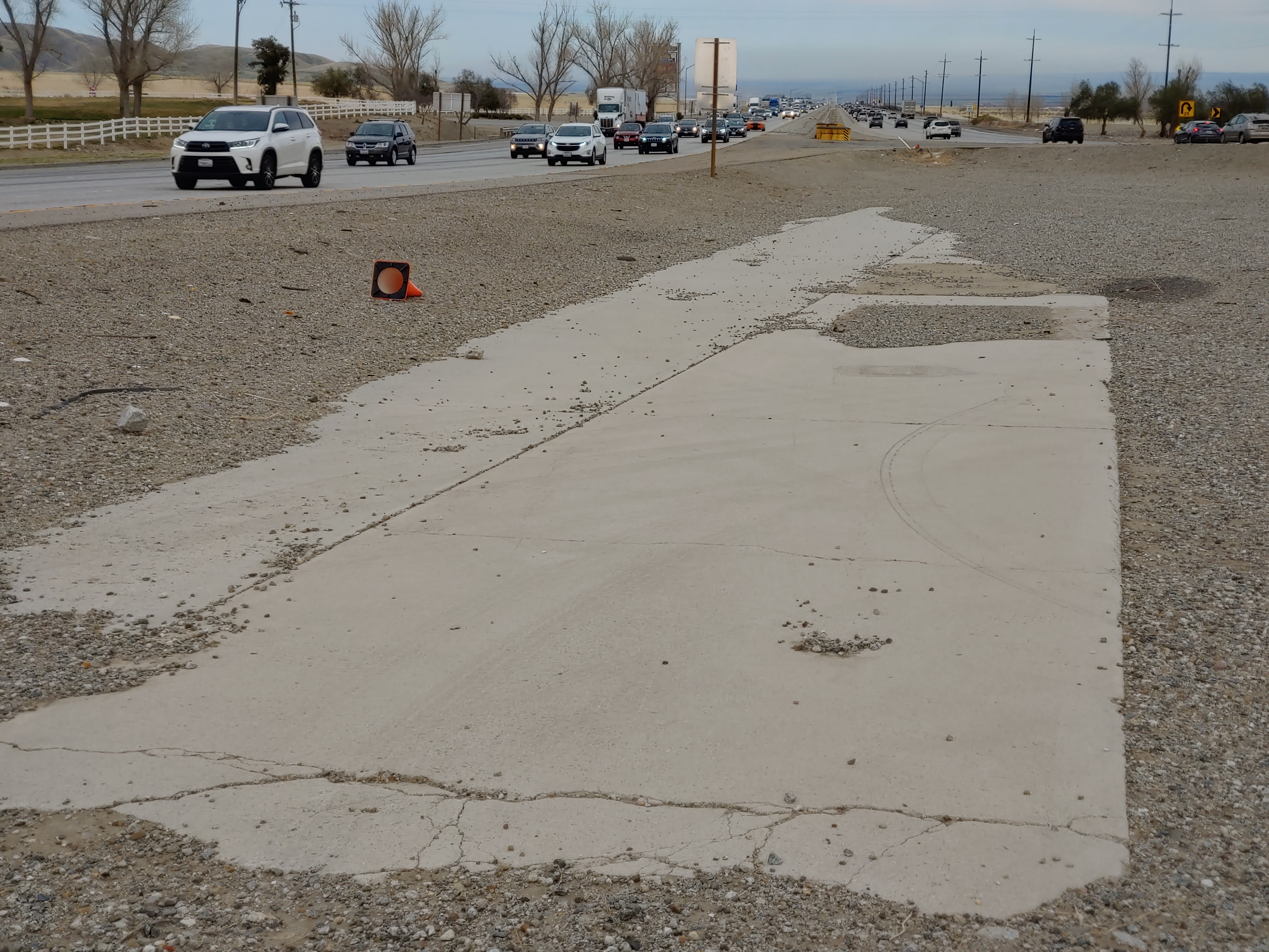
Just south of Madera, 1.75 miles south of Ave 12, and 2.1 miles north of Ave 9 (or more specifically at 06-MAD-99-05.7), there lies a pine tree and a palm tree in the median of Highway 99. It has been there since the 1920’s and marks the former halfway point in California. The Palm Tree, a Canary Island Date Palm, represents Southern California and the Pine Tree, a Deodor Cedar, represents Northern California. In 2005, the pine tree fell down but was replaced by Caltrans in 2007 as this is a somewhat historic marker.
We, the Historic Highway 99 Association of California, intend to have signs placed in both directions at this location to mark the historic site. While it might not exactly be the “halfway” point in California, it is close enough and has been there since the 1920’s. We are looking to work with local agencies such as the County of Madera, Caltrans District 6, City of Madera, and others to gain support and assistance with this effort. We already have a design for the sign and cost estimates for its fabrication.
If you would like to be involved in this project (03-MAD21002), let us know! We can use help either through donations of labor or money. Any donations are likely tax-deductible as we are a 501c3 organization.
99 Alert – William S Hart Park in Santa Clarita
One of our members and local historians, Evan Decker of Santa Clarita, has brought to our attention something concerning a park in his area. William S Hart Park, the former home of the silent film actor, is currently a park owned and administered by Los Angeles County. This arrangement is due to the stipulations in the will of William S Hart, who deeded the land and associated structures in perpetuity to Los Angeles County.
The City of Santa Clarita, in an effort spearheaded by the current major Laureen Weste is looking to take over the park. By itself, it would seem like a “home rule” sort of issue, which can be a good thing. However, the City of Santa Clarita has a poor track record of preserving history and keeping it safe. This has been shown with the “disneyfication” of the central business district of Newhall, among other things. We feel this change would be a detriment to the historical value of Hart Park and would not be to its best interest.
If you would like to help with preventing the City of Santa Clarita from taking over William S Hart Park, Even Decker has set up an online petition to sign. He also strongly recommends contacting the office of Los Angeles County Supervisor Kathryn Barger and tell her you’re against this project.
We, the Historic Highway 99 Association of California, only want to help preserve and protect the history along Highway 99. Newhall was one of the towns along the earliest alignment of US 99. Hart Park represents a part of that early history.
Please sign the petition created by Evan Decker to tell the City of Santa Clarita that you want the park kept as-is and not in City hands.
Membership and Donations
As we slowly ramp up our efforts to get Historic Route signage placed in various cities and historic locations such as the Pine and Palm, we need your support. You can do this by becoming a member, donating money, or by volunteering with our Association. We are a 501(c)3 non-profit corporation and your donations may be tax deductible. Why not help reduce your tax burden for 2023 by donating prior? We can also use your help with some of our projects, website, and our newsletter. Having someone local to act as our ambassador or liaison would be of great help. We are also working out how to handle renewals for existing members. Initially, we had planned to have all memberships expire at a specific time. At this time, we are looking to have memberships expire at the end of the month initially obtained. We will be sending out a letter to our current members to explain how to renew. Join now and help us grow!
We do wish to thank all those that have donated and become members thus far. Our most recent project in Madera couldn’t have happened without your support!
Featured Photo
Hawkbryn Ave in Newhall, CA. Courtesy – Michael F Ballard
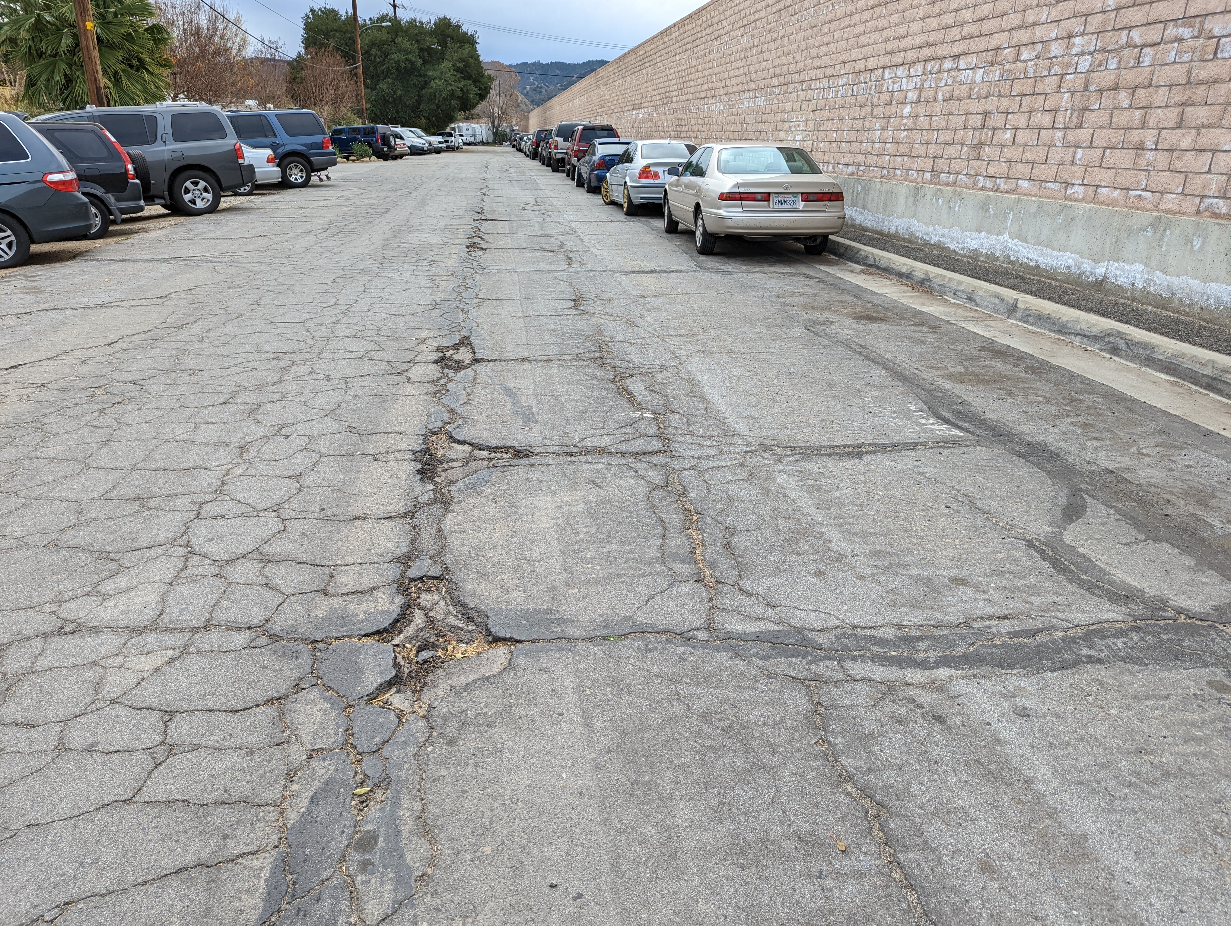
Recently, a section of 1930 US 99 was rediscovered in the Santa Clarita Valley. Thought lost since the 1960’s, a small section of the 1930 “Newhall Alternate” was found along a residential street south of Lyons Avenue. This roadway, at least a portion of it, represents one of the few remaining sections of the 1930 roadway north of Calgrove Blvd. In 1967, I-5 was constructed here and the new road was shifted a little to the west, leaving this road, now known as Hawkbryn Ave, as a frontage road. Traces of the 1930’s concrete can still be detected today. This section was discovered using comparisons between aerial photography and the construction plans from 1949 and 1967.
Despite having traversed this area many times, I never thought to look here. Always keep your eyes open, for you never know what you might find.
One of our members and local historians, Evan Decker of Santa Clarita, has brought to our attention something concerning a park in his area. William S Hart Park, the former home of the silent film actor, is currently a park owned and administered by Los Angeles County. This arrangement is due to the stipulations in the will of William S Hart, who deeded the land and associated structures in perpetuity to Los Angeles County.
The City of Santa Clarita, in an effort spearheaded by the current major Laureen Weste is looking to take over the park. By itself, it would seem like a “home rule” sort of issue, which can be a good thing. However, the City of Santa Clarita has a poor track record of preserving history and keeping it safe. This has been shown with the “disneyfication” of the central business district of Newhall, among other things. We feel this change would be a detriment to the historical value of Hart Park and would not be to its best interest.
If you would like to help with preventing the City of Santa Clarita from taking over William S Hart Park, Even Decker has set up an online petition to sign. He also strongly recommends contacting the office of Los Angeles County Supervisor Kathryn Barger and tell her you’re against this project.
We, the Historic Highway 99 Association of California, only want to help preserve and protect the history along Highway 99. Newhall was one of the towns along the earliest alignment of US 99. Hart Park represents a part of that early history.
Please sign the petition created by Evan Decker to tell the City of Santa Clarita that you want the park kept as-is and not in City hands.
On November 23, 2021, we celebrate our first year as a California Non-Profit Public Benefit Corporation! We have done a lot in our first year and have a lot more to do in the future. In March 2021, we posted our first signs in the city of Calexico and were granted our 501(c)3 status. We also started memberships at the time. Our memberships are growing and now cover California, Oregon, Washington, and British Columbia. In September 2021, we worked with the city of Madera to post new signs along their portion of Historic US 99 known as Gateway Drive. We’ve been in two newspapers so far because of these projects.
I am very proud of what we have been able to accomplish in such a short period of time. We could not have done any of this without all your support and wish to thank all that have contributed their time and money toward our efforts. We also would love to hear from you! What are your thoughts about what we’ve done? Would you like to help? We need your help to represent us throughout the state. We’d love to hear your feedback.
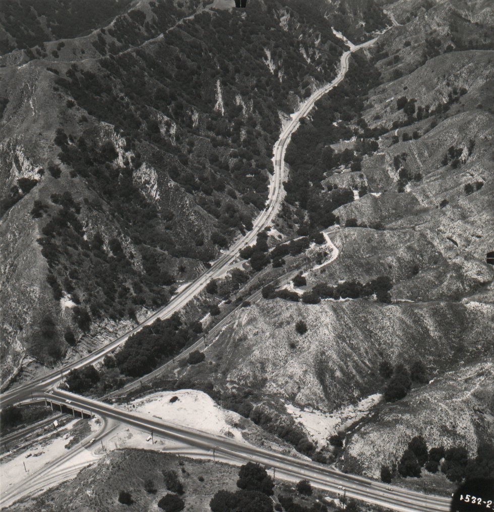
US 99 and Newhall Pass – Part 2
by Michael F Ballard
Looking north through Weldon Canyon in 1949. Courtesy – Caltrans.
Upgrading to a Four Lane Expressway
By the early 1940’s, it became evident that yet another improvement had to be made to the highway. World War II postponed most of the planned improvements for US 99. A plan to widen US 99 to four lanes along its entire course was begun in 1947. On June 24, 1948, a contract was awarded for a 3.3-mile segment, Saugus Junction to Pico Canyon. It was completed on April 8, 1949. In this case, the widening was cheaper, costing only $450,000, as only minor realignments had to be done. The old lanes were used for the northbound side and a new set of lanes was added for the southbound side. The Weldon and Gavin Canyon sections were finally widened to a four-lane expressway in 1951. The old concrete could not be used and had to be demolished, as this section required considerable straightening. The new lanes were made of eight-inch concrete 24 feet wide with a division strip of varying width. These two new roadways had asphalt shoulders that were eight feet wide on the right and five feet wide on the left. The realigning of the roadway involved the excavation of over 700,000 cubic yards. Total cost for this section amounted to about $1 million.
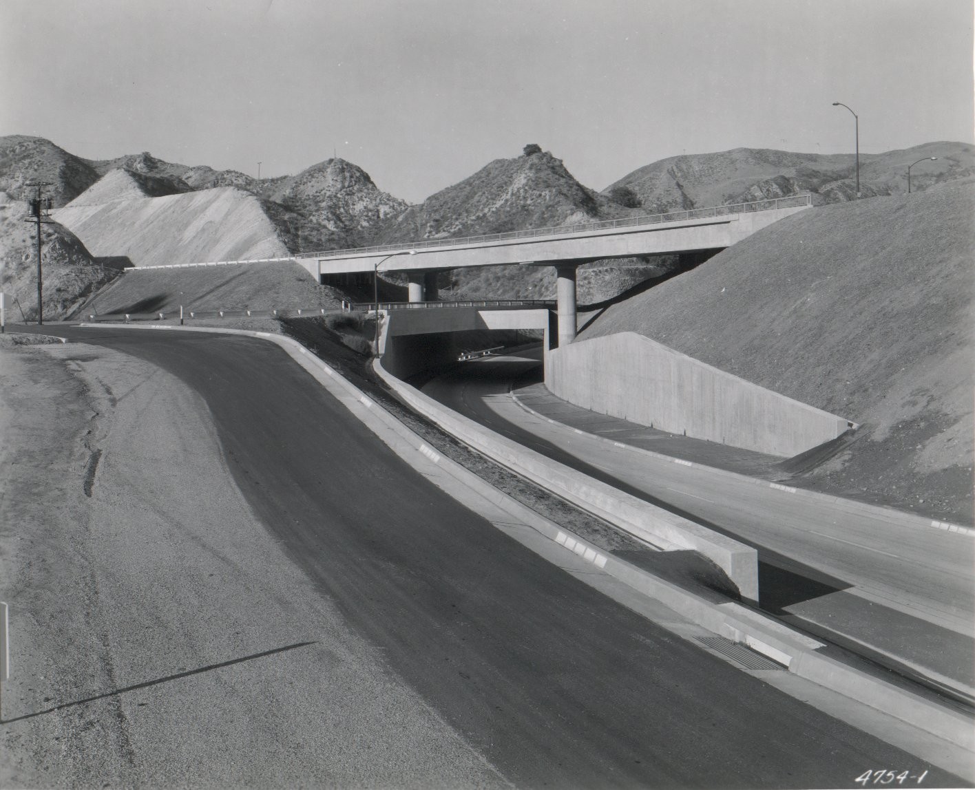
By 1953, traffic had increased to the point where the next step had to be taken – grade separations. The first section of freeway was completed in 1954. It ran from San Fernando Road near Sepulveda Boulevard (Sepulveda Junction) to the base of Weldon Canyon. This new freeway had many features which greatly improved traffic flow through here. A three-level interchange was constructed at the junction of US 6 and US 99. Direct ramps were constructed to connect northbound US 99 traffic to northbound US 6 and southbound US 6 traffic to southbound US 99.
Three-Level Interchange at US 6 and US 99 in 1955. Courtesy – Caltrans.
Upgrading to an Interstate
The first segment of US 99 in the Santa Clarita Valley to be reconstructed as an Interstate was between Saugus Junction and Castaic Junction. That freeway, completed in 1964, still carried US 99 shields on the overhead signs. This was done to ease the transition to I-5 from US 99. The completion of the freeway eliminated two major traffic signals along the old highway. From 1967 to 1968, the rest of old US 99 was upgraded to a full freeway. The original freeway through Newhall Pass is now used as the truck route and has been since the interchange was reconstructed with State Highway 14, the Antelope Valley Freeway. The new interchange is located just a half mile northwest of the old interchange.
Earthquakes and Newhall Pass
On the morning of February 9, 1971, it was still under construction when the Sylmar / San Fernando earthquake struck. Most of what was built collapsed, killing two people in a pickup truck below. It also crushed a newly constructed crane, which was set to be used for the first time that Tuesday morning. The interchange was subsequently rebuilt and finally completed in 1975. However, on January 17, 1994, two of the bridges collapsed in the Reseda / Northridge earthquake. It took less that a year for the interchange to be rebuilt which is remarkable for reconstruction of a major, and functioning, freeway interchange. The old expressway in Gavin Canyon was used as a temporary freeway after the Gavin Canyon overpasses partially collapsed leaving one big rig and a few cars stranded on an island in the sky. The original 1951 concrete was paved over at that time. The center concrete barrier and metal guardrail were also added at that time.
Highway 99 In the News
We were in the news on Saturday, October 9, 2021! The Madera Tribune, a local paper covering Madera County, printed the press release that was issued by the City of Madera for our latest signing project. Getting ink, no matter how, is pretty cool. Every little bit helps with awareness of our organization and spreading the word of our goals.
A look at where the Lincoln Highway, America’s first Transcontinental Highway, 1913-1927, meets Highway 99 in California Central Valley. We will discuss why the Lincoln Highway chose the central valley route to Altamont Pass instead of a more direct one. Hint, there wasn’t any. When the Lincoln Highway ceased to exist, the number system Highway 99 took over from Sacramento south. We will look at some places where you can still see some of the histories of these two famous roads.
Along with his wife Monica, Trey created “Adventures in California History,” an ongoing exploration of historic California. Trey is currently the Vice-President of the Lincoln Highway Association.
Join us on November 2, 2021 at 6 pm for a Zoom presentation.To register, please use the link below:
We are looking to expand our organization. With the number of cities interested in Historic Route signage growing, we need your support! Donations big and small are also welcome. Any donation above $20 will include an optional one-year membership. We are also working on a potential “Lifetime” membership, which will be above a specific donation amount.
Signing up is easy! Join us as a member and help us grow!
We restarted our online discussion forums for Historic Highway 99. Come join in! Tell your Highway 99 stories, discuss your favorite place along the road, learn about the history, and more!
Things are looking up! We have a few projects in the works at various levels now. In Madera County, we are working on posting signs to mark the Pine and the Palm along Highway 99. We are also looking into getting it designated a “Historic Landmark”, which is something we will need help with. We intend to work with local historical societies, Madera County, and Caltrans to get this done. If you have an idea for a project for the 99 Association or would like to get involved, let us know!
Board Position Open
We are currently seeking a Treasurer for our organization. If you are interested, or know someone that might be, contact us. We’d love to have you as a part of our team and help keep Historic US 99 alive in California!
Featured Book
On Creating Our Highway 99 Books
By Jill Livingston
The occasional sighting of the abandoned Dog Creek Bridge off to the side of I-5 in the Sacramento River Canyon never failed to thrill, and frequent drives through the rocky, bridge-bejeweled Shasta River Canyon on old 99 finally prompted an “aha moment.” My sister and I looked at each other and said, “Someone should do a book about this! Shall we? Can we? How?” And the fact that these northern artifacts are connected to that long, hot highway through the Central Valley we often traversed as kids, and later traveled 99 north on a trip to the 1962 World’s Fair in Seattle made this two-lane highway all the more intriguing.
But this was 1994. Back in those ancient days the internet was barely emerging, so doing research was not an easy thing. Nor was “self-publishing.” Our research started simply with driving around and looking for segments of old highway. I have to think that when we found something, it was much more satisfying than the way it goes nowadays; finding out on Facebook that a segment of old road is in such and such a location, go see it. Our trips were truly trips of discovery! I’ll never forget how excited we were when we stumbled upon the old Salt Creek Bridge that had appeared with a lowering Shasta Lake (yes, there were dry years back then too.) And along the way in our travels we visited any local history museums we could as well as the CalTrans Library in Sacramento and Bancroft Library in Berkeley. I even found a few gems in our small local library, such as the Depression era WPA California guidebook with its colorful descriptions of towns along the way.
After considerable trial and error, we came up with a good format for our books: background history in the chapters, a pictorial Tour (using both contemporary and historic photos), a road log and maps in the back. I’m proud that one reviewer called the Ribbon of Highway series the “seminal” Highway 99 books. Several other books have come out since our first publication as this hobby (obsession?) has grown in popularity, and every one contributes to the story. Over time we published new improved editions and covered the entire highway from Canada to Mexico in three books.
It’s sad that so much roadside archeology has disappeared in the last decades, such as neon signs, vintage auto courts, historic bridges replaced, etc. But it’s fun to see how many people have enthusiastically taken to exploring the old roads.
To purchase a copy of “That Ribbon of Highway” and other books by Jill Livingston, please check out their website:
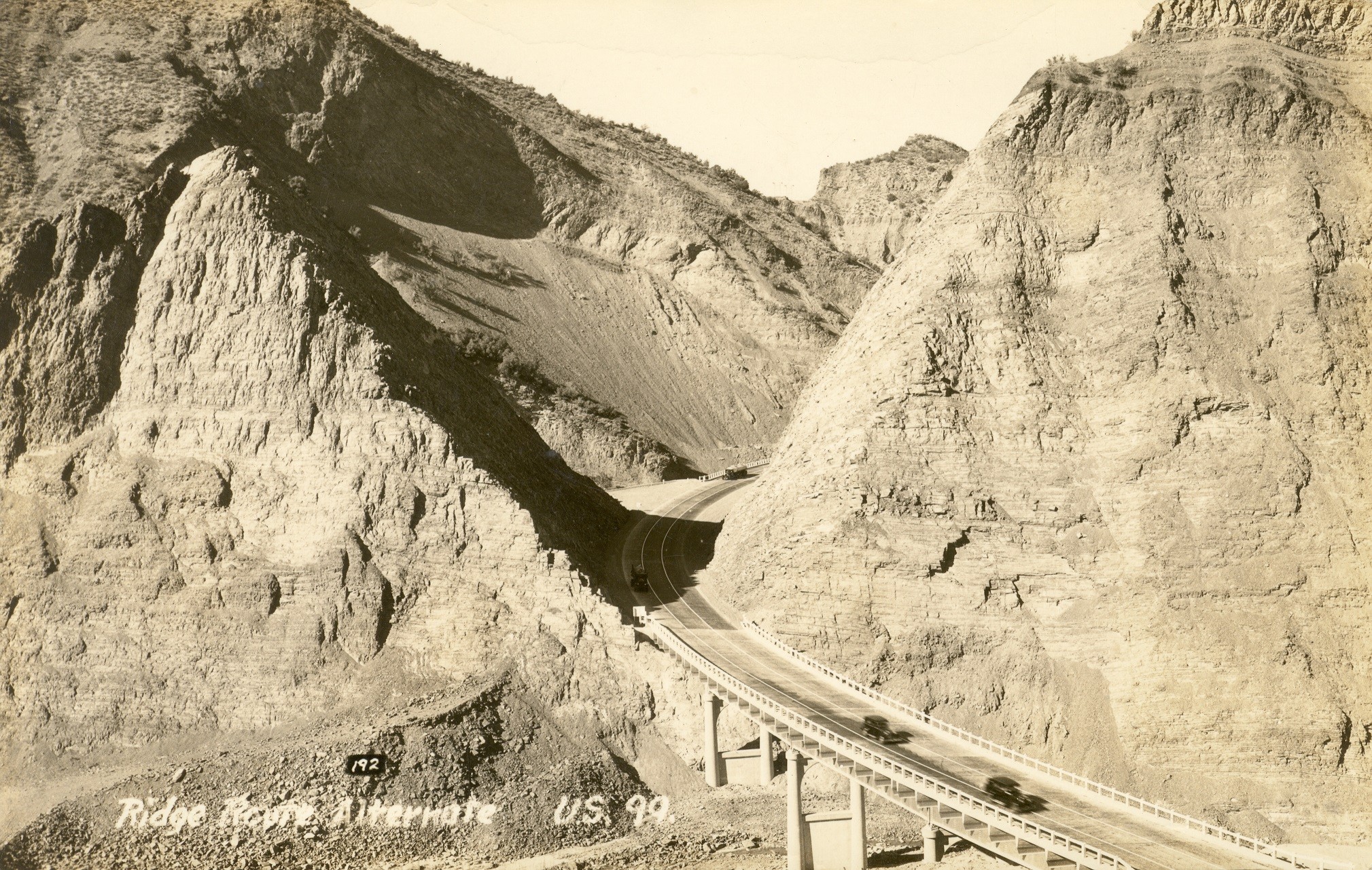
On October 29, 1933, four years to the day following the great stock market crash of 1929, the Ridge Route Alternate officially opened to traffic. This new road bypassed the treacherous 1915 Ridge Route by many miles, relegating it to a forgotten side-road. This also marked the opening of the largest realignment of US 99 in California. No other section was relocated as far from the original alignment. Today, the view shown in the postcard above is still possible, with one major change. Pyramid Rock and Cut remain, but a large dam is now directly behind it.