
US 99 and Newhall Pass – Part 1
by Michael F Ballard
The first paths through Newhall Pass were Native American foot trails. They went from Los Angeles to the Mojave Desert and the San Joaquin Valley. These trails were used for trade between the desert and the Los Angeles Basin. As Los Angeles grew in size from a sleepy Mexican pueblo to a major city, Newhall Pass became increasingly important to trade and travel. In 1852, the first improvements to Newhall Pass were implemented. Henry C. Wiley created a windlass system to carry stages and wagons over the bluffs. The windlass system used ropes and pulleys that sometimes broke, dropping whatever was being held up, down to the ground. This system lasted for only two years until General Phineas Banning excavated a thirty-foot deep cut into the bluff. On December 5, 1854, he drove the first stage through the cut. This helped greatly to improve the pass. On October 21, 1858, Banning drove the first stage of the Butterfield-Overland Stage Route through the pass.
Beale and his Cut
In 1863, nine years after General Phineas Banning excavated through the bluff, General Edward F. Beale deepened the cut to ninety feet. This was the biggest improvement to the pass since Wiley’s windlass. However, when Beale deepened the cut, he also added a toll. The tolls were $2.50 for a 12-horse team, 25 cents for a horse and rider, 10 cents for miscellaneous arrivals, and 4 cents each for sheep.
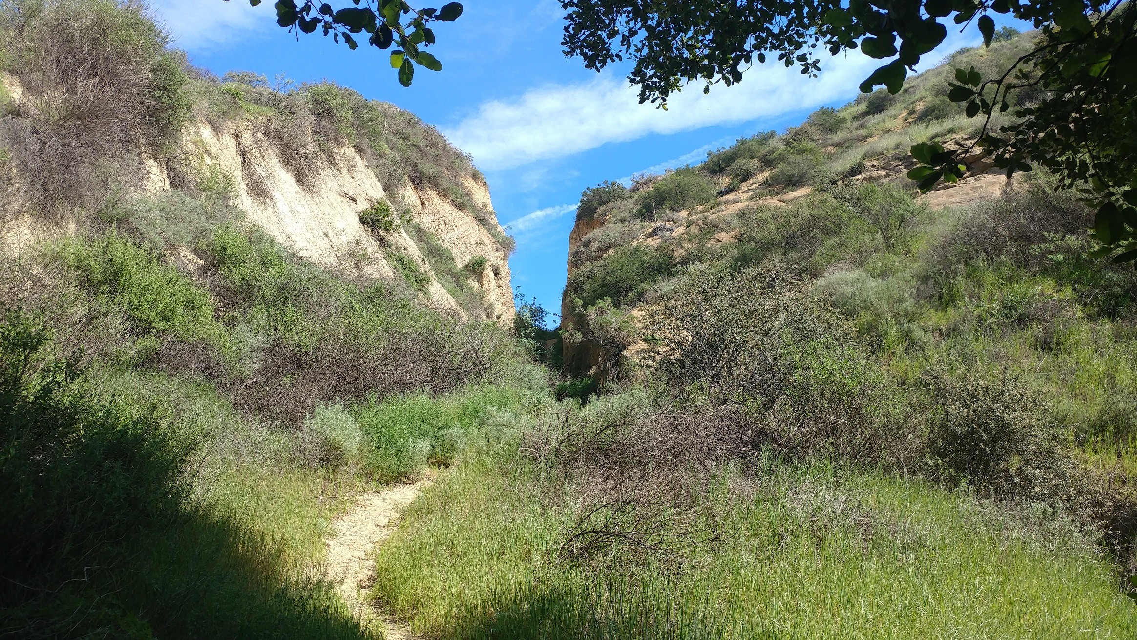
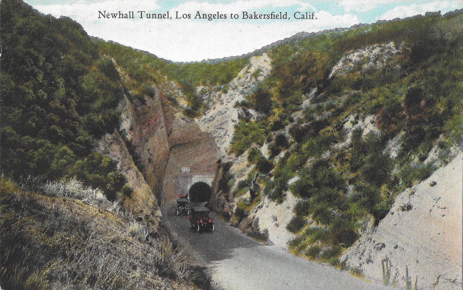
Beale’s Cut, as it came to be known, lasted as the main road for many years. In the early 1870’s, the first asphalt paving was added to the road to help keep the dust down. The last improvement made to the cut was in 1909 when it was deepened an additional ten feet to make it more passable by automobiles. In 1910, the County of Los Angeles constructed a tunnel to bypass the steep grade and cut. The tunnel, which measured only 17 ½ feet wide by 17 feet high and was 435 feet long, did relieve traffic temporarily. Not only did it make travel easier through the pass but it also eliminated the 29% grade that led up to Beale’s Cut. This was also one of the first contracts let for the building of the Ridge Route. Initially, the pavement was only 15 feet wide along here. Eventually in the late 1920’s, it was widened to twenty feet.
Once again, Newhall Pass became a bottleneck. The tunnel was so narrow that if two trucks traveling in opposite directions met at the tunnel, only one could pass through at a time. A traffic count taken on Sunday, January 15, 1928 showed that a total of 9,730 cars came through this tunnel. Weekdays averaged only 3,500 cars daily. Traffic could back up for two miles on each side of the tunnel if an accident occurred. On one of the worst days on record, 20,000 cars passed through the tunnel in just nine hours.
Construction of the Newhall Alternate
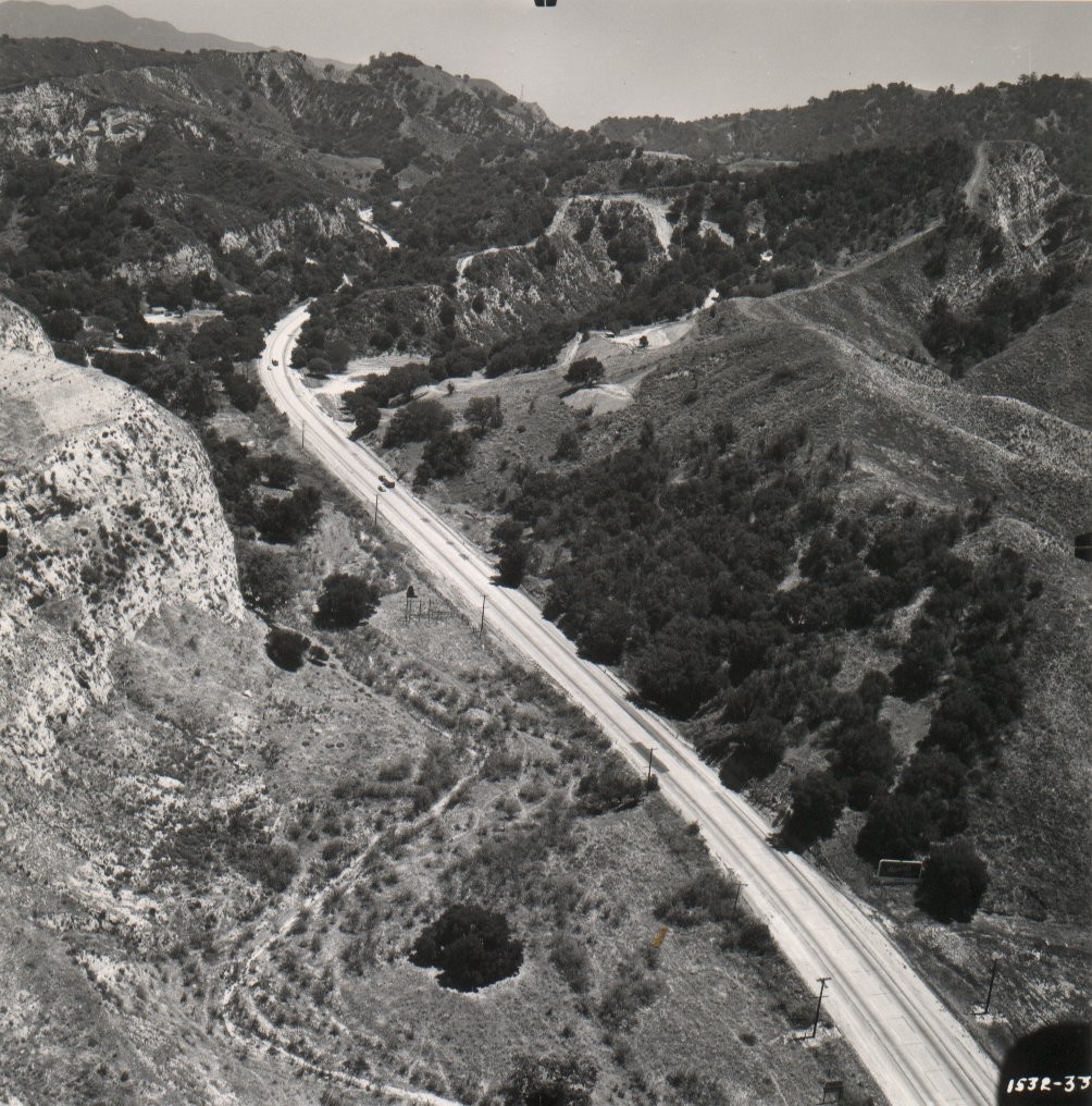
In the late 1920’s, the need for a bypass or a complete elimination of the tunnel had become very evident. The fact that the highway became US 99 in 1926 just added extra impetus for a bypass. Construction began on a bypass through Weldon Canyon late in 1928. Weldon Canyon was named after Victor Weldon, a local rancher. It was the first road to be built through there. The new alignment started at the Tunnel Station Viaduct, which was originally built by the City of Los Angeles in 1911 and widened in 1935, thence up Weldon Canyon and Gavin Canyons back to the old alignment near the Santa Clara River. The new route only saved 1.2 miles but it gave travelers another way to go north thus relieving traffic over Newhall Pass. The new roadway, called the Newhall Alternate, was 8.6 miles long, forty feet wide, and paved with three lanes of concrete. Each lane was ten feet wide, the standard at the time. It eliminated Newhall, Saugus, and the Newhall Tunnel from the Ridge Route. It was finally opened to traffic on May 28, 1930.
Part 2 coming next month.
Madera Historic Route 99 Signs
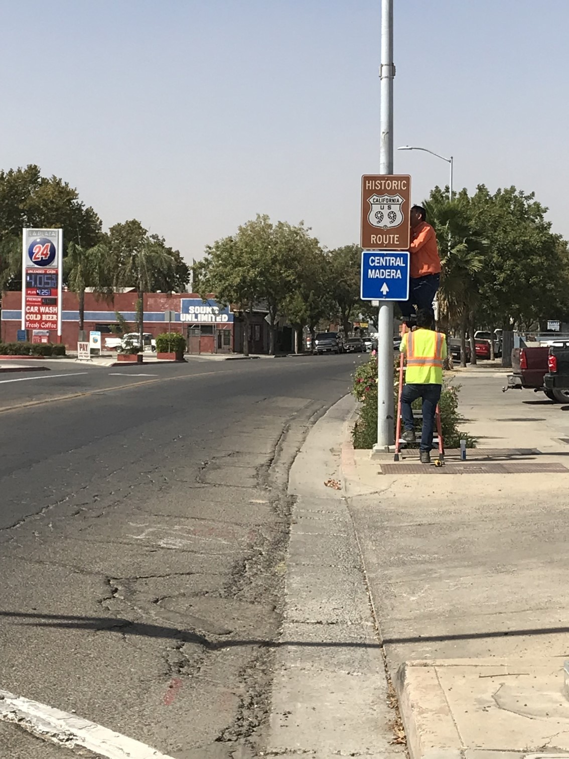
We have some great news! After speaking with officials with the City of Madera, they have agreed to post our Historic Route signs along Gateway Drive. This is the first new signage we will be placing, as Calexico was replacing existing signage. Getting approval in Madera is a significant accomplishment for us and I look forward to many more in the future.
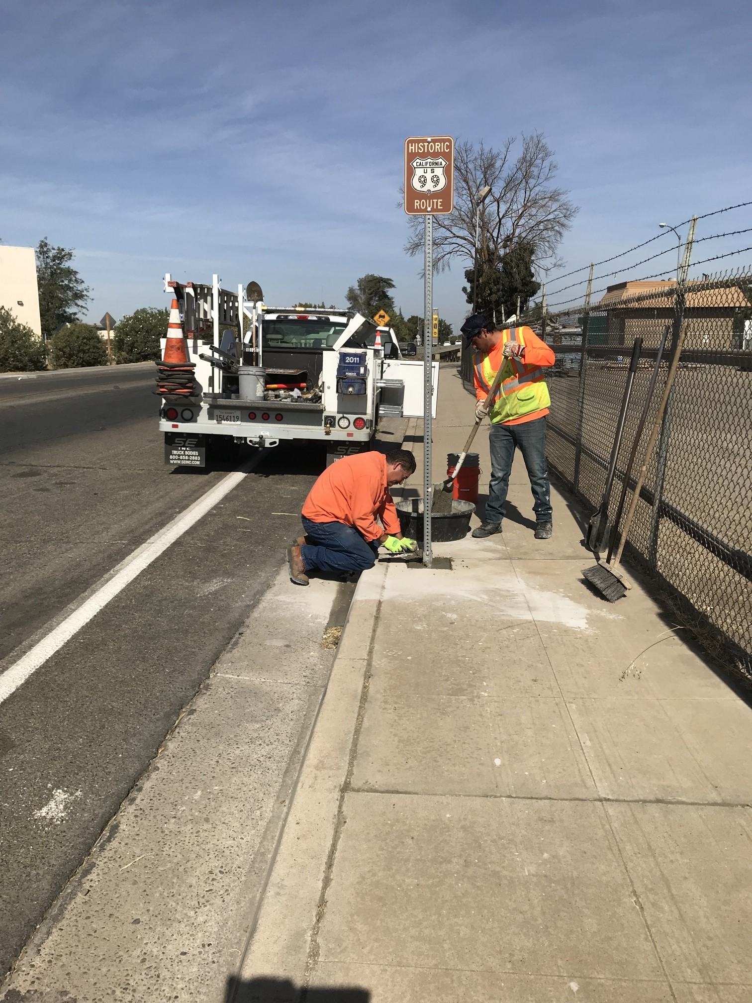
The new signs were posted on September 29, 2021. They were placed along Gateway Drive at Olive Ave, Yosemite Ave, Central Ave, and near Ave 16. We will make an announcement when we have more details regarding any newspaper articles that may come out. This is such a huge success for the Association and the City of Madera! The signs were designed by Jake Bear.
I would like to thank all of our members and donors, the City of Madera and their Public Works Department for helping make this happen. We couldn’t have done this without all your support!
Coming up next, maybe Ontario?
October Presentation
A car passed by the St. Francis Dam on the way to Powerhouse 1 on March 12, 1928. The driver saw a torch light at the base of the dam, and figured the dam keeper, Tony Harnischfeger was down at the base of the dam. A little while later, a motorcycle passed by the St. Francis dam just before midnight. The driver, Ace Hopewell, glanced over to the dam as he passed. All was calm. One can imagine how beautiful it was in the moonlight, giving off a white glow. He continued on his way to Powerhouse 1, where his shift began at midnight. A few minutes later, he heard a terrible crash. He stopped his motorcycle, smoked a cigarette and listened to the loud crashing sound. The area was known for landslides in the area….the Pelona Schist was unstable and often collapsed on to the road. He listened until the sound began to subside, and carefully, he continued on to work, looking for fallen rock. It wasn’t until he arrived at Powerhouse 1, that he was told that the St. Francis Dam had gone out. He was the last living person to see the dam intact.
Join us on Tuesday, October 5 at 6:30 pm, for the story of the St. Francis Dam, the 2nd largest tragedy in California as far as loss of life.
Presented by the St Francis Dam National Memorial Foundation.
https://us06web.zoom.us/meeting/register/tZEldOCtrzwvGdwOa469Nmrkp4ppYiNmI-CV
Featured Photo
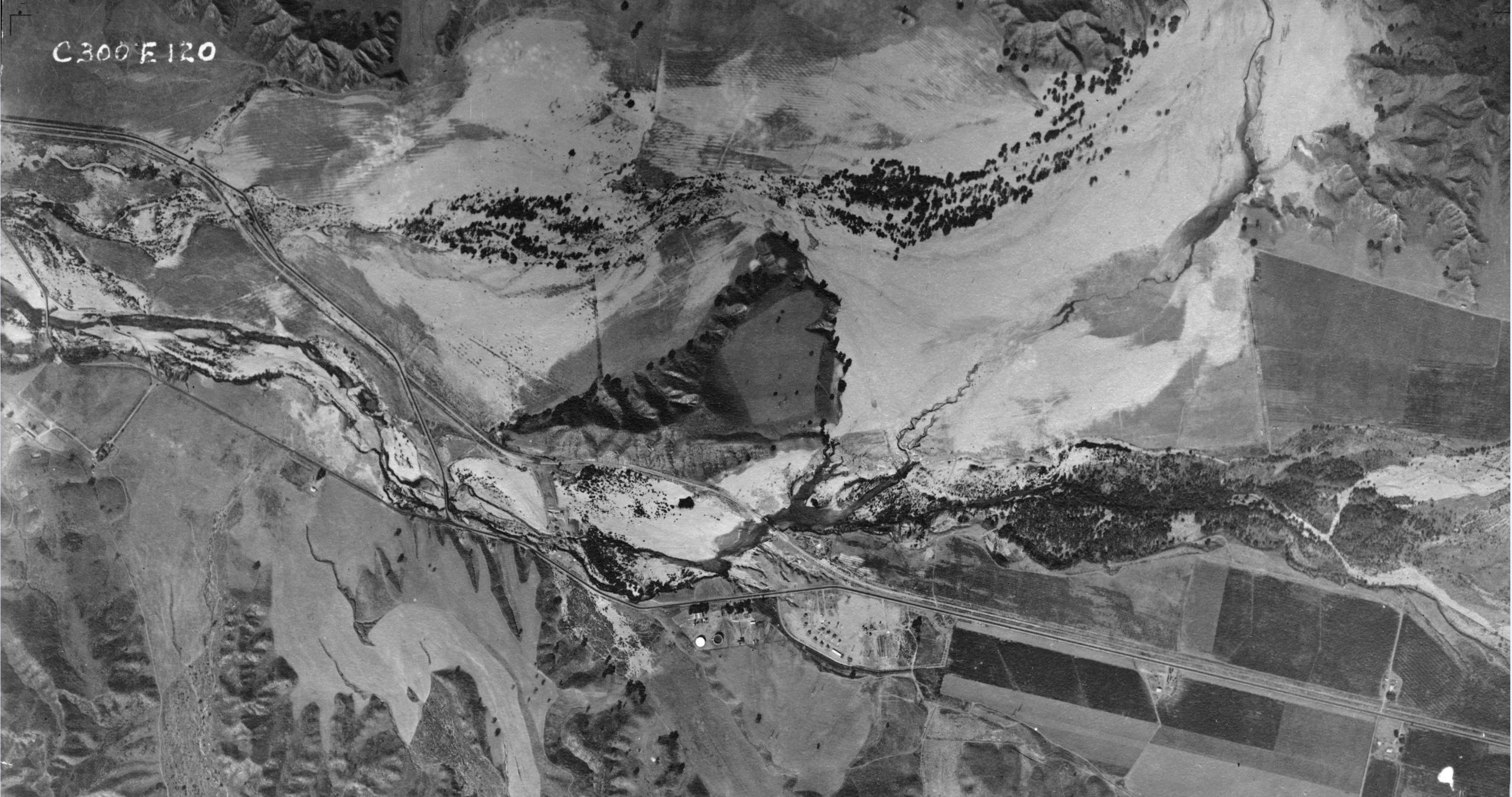
The collapse of the St Francis Dam just before midnight on March 12, 1928 caused a great deal of devastation all the way to the Pacific Ocean. Some areas were more permanently affected than others. San Francisquito Creek was shifted east, joining the Santa Clara River near present-day McBean Parkway instead of closer to Castaic Junction. Prior to the flood, US 99 crossed San Francisquito Creek on a 100 foot long steel through-girder bridge. Today, that same crossing is a small culvert. US 99 was also realigned at its crossing with the Santa Clara River, a project that was already in the works prior to the flood. The loss of the original 1916 through-truss span hastened the process with the new bridge being completed in early 1929.
Travel Guide Available
A free copy of a US 99W Travel Guide by Mike Herman from the Historic Ukiah-Tahoe Highway Association is available to members only. Contact us for details!
Board News
We are currently seeking a new Treasurer for our board. Sara Lazarus, our last Treasurer, served us well during her tenure but is no longer able to continue serving in the position due to prior obligations. Contact us if you’re interested in serving. We can use the help and support!
Errata
We are also reintroducing our Highway 99 Discussion Boards after a long hiatus. The old ones had to be deleted due to server issues which have since been resolved. Join the conversation and share your knowledge about US Highway 99.
https://historic99.org/forums/
Changes to our newsletter are coming! Coming up next year, we will be moving to a bimonthly format. Our newsletter, named the Historic Highway 99 Explorer, is also available in a printable PDF format, which can be downloaded on our Newsletters page. If you would like to write an article for our newsletter, contact us and we will talk! You can find our back issues on our Newsletters page.