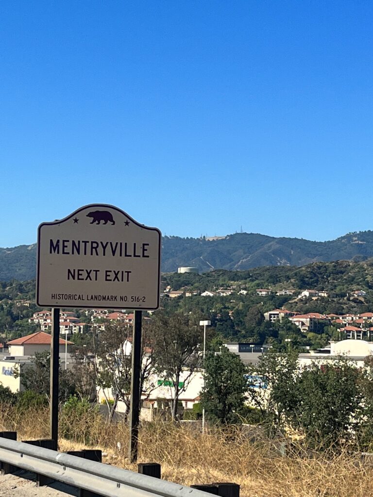
If you’ve recently driven along the 5 Freeway (Interstate 5) near the Lyons Avenue/Pico Canyon Road exit recently, you’ll notice some new California Historical Landmark wayfinding signs for the historic oil boomtown of Mentryville which was established in 1876. It is so important that historic sites such as Mentryville deserve the proper recognition they deserve. A huge Thank You to the California State Office of Historic Preservation as well as CalTrans for making these signs a reality.
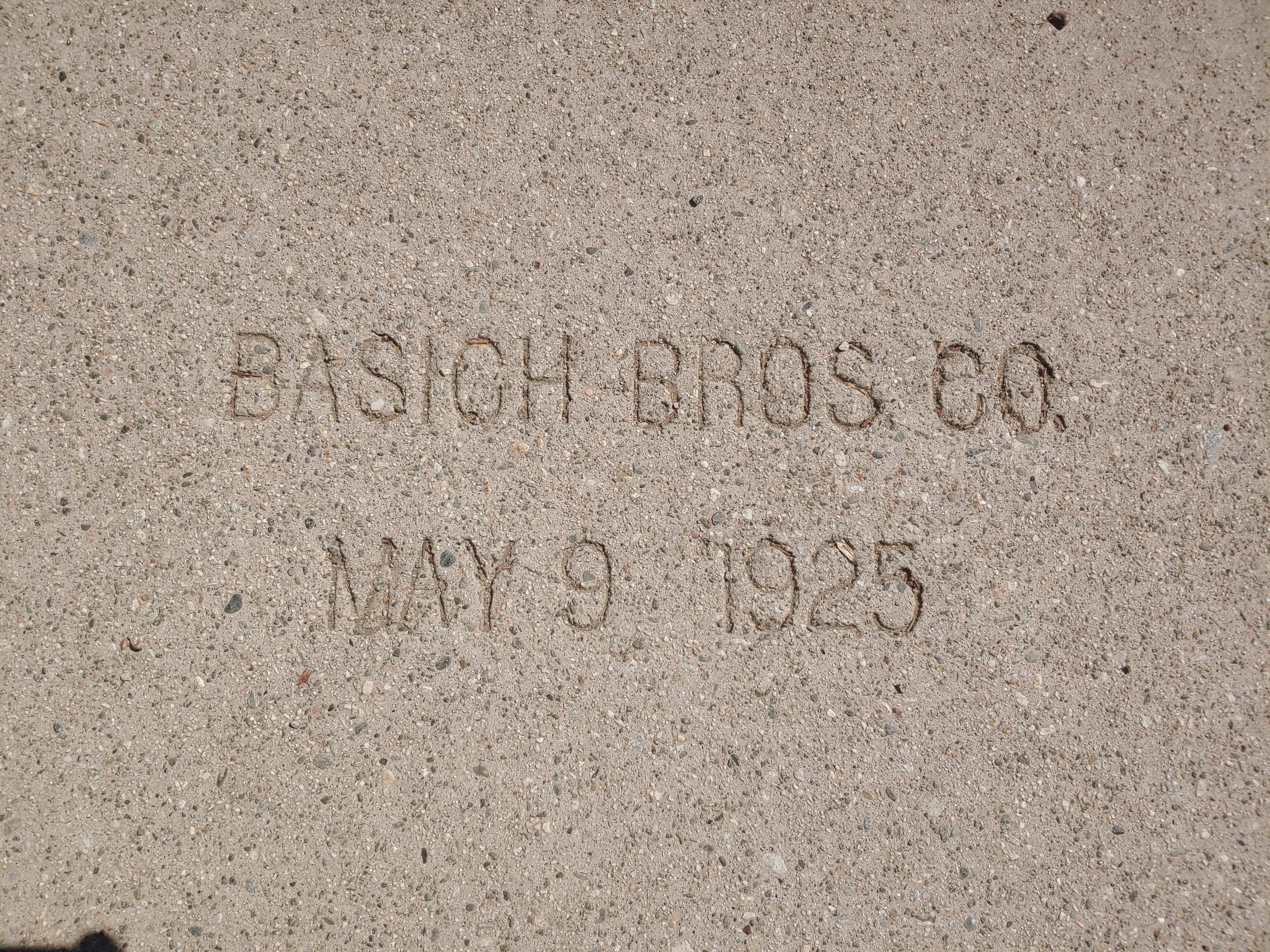
Good news from Calimesa! Our campaign to save the date stamps from the 1925 paving on Roberts Road is a success! The stamps will be removed from the existing paving in the very near future and held by the City of Calimesa to be displayed at their new library. We will post additional information on any events or ceremonies as we get closer.
We wish to thank all who helped us in this preservation effort!
We are planning our first CUTRR – Clean Up The Ridge Route – event to be held on May 20, 2023. The road has suffered through a lot this winter and it needs your help! Our work will concentrate on clearing drains of debris on the northern end between the Tumble Inn and Reservoir Summit. Due to conditions, we won’t be able to go over the entire roadway afterward as we have done in the past. Additionally, lower clearance vehicles are not recommended on the Ridge Route at this time.
Please RSVP so we can get a rough headcount before the event. We look forward to seeing you all out there!
Please be in sturdy shoes, pants, and shirt. Hats and protective glasses are recommended depending on what work you’ll be performing.
Tools Needed:
Bring whatever tools you have to cut branches and clear debris. Supplies such as picks, shovels, rakes, pruning saws, pole pruners, mattocks, clippers, wheelbarrows, brooms, and other items may also be needed.
Meeting Location:
We will be meeting at the Gorman Carl’s Jr, 49669 Gorman Post Rd, Gorman, CA 93243, at 0800 hrs on May 20, 2023 and will be leaving by 0830 hrs.
Either through heavy wind, corrosion, or a combination of the two, a section of “greenout” fell off a sign on the eastbound Ventura Freeway (State 134) recently at Victory Blvd. This sign, approaching the Golden State Freeway (I-5) has been there since 1961 when the freeway opened. In 1961, the Golden State Freeway was still US Highway 99. In 1965, the sign was covered over with an overlay for I-5. In early 2023, that overlay (“greenout”) fell off, revealing a portion of the original signage. The left side of the sign has a State 134 EAST sign as 134 proceeded east toward Pasadena via the Golden State Freeway and Colorado St until 1968.
It’s been a while since our last newsletter went out. Things have been somewhat busy on my end, and it isn’t easy to get these going. Help is very much needed and appreciated. We are looking for volunteers to help with the newsletter, articles, and more. Our newsletter is also now going to quarterly, albeit this one was a bit late.
Our Association breaks the state up into four regions. We’d like to put YOU in charge of one of the regions. You can be our regional contact or reporter. You can use the newsletter and website to help promote various events, businesses, and locations along Historic US 99.
Contact us if you have any questions, interested in writing for this newsletter, or giving a presentation for the Association. We’d love to hear from you!
Now onto 99 business. Winter has been a bit harsher lately, with heavy rains and snows along the route. The Ridge Route / Grapevine has been closed at times due to snow and mudslides. Lake Shasta rose quite a few feet over the course of a few days inundating long sections of historic highway. Rare avalanches were visible from I-10 in Beaumont Pass coming down from Mt San Jacinto. All this and we’re not even done yet. To this end, here are some tips for travel over The Grapevine / Ridge Route during winter.
Ridge Route / Grapevine Winter Travel Tips
I-5 between Santa Clarita and the San Joaquin Valley over Tejon Pass is known as “The Grapevine” and formerly known as “The Ridge Route”. It is an important corridor in California and has been so since 1915. Travel over the route can be quite treacherous in winter due to both rain and snow. Mudslides, rockfalls, and ice can all wreak havoc on travel. Caltrans, CHP, and the County of Los Angeles work together to ensure safe travel over the route. Sometimes this can result in a full closure of the pass.
STATS:
Highest elevation – 4144′ at Tejon Pass
Normal Closure Points:
Southbound at Grapevine (Exit 215)
Northbound at Castaic – Lake Hughes Road (Exit 176B)
ALTERNATE ROUTES:
If the 5 is closed, alternate adjacent routes such as Lake Hughes Road are not advisable as they may be in worse condition or be heavily congested. Depending on closures, the best alternative to I-5 is via State 14 (Antelope Valley Freeway) and State 58 over Tehachapi Pass. In times of heavy snow, your only option may well be US 101 to State 46 in Paso Robles. Check with Caltrans and CHP prior to travel to make sure these roads are open.
SPECIAL NOTE:
The Old Ridge Route (Ridge Route Road) is never an alternate to I-5 under any conditions and is not suitable for heavy traffic nor is it open to through traffic.
To stay up-to-date on current conditions, we recommend the following sites:
Quickmap – Caltrans Traffic Map with CHP Incidents and Cameras
Be safe out there and always use caution during winter months when traveling the “Grapevine”.
Membership and Donations
We need your support for our efforts to get Historic Route signage placed in various cities and historic locations such as the Pine and Palm. You can do this by becoming a member, donating money, or by volunteering with our Association. We are a 501(c)3 non-profit corporation and your donations may be tax deductible. Why not help reduce your tax burden for 2023 / 2024 by donating prior? We can also use your help with some of our projects, website, and our newsletter. Having someone local to act as our ambassador or liaison would be of great help. Join now or renew and help us grow!