September 2021 Newsletter

US 99 in Colton, California

by Michael F Ballard

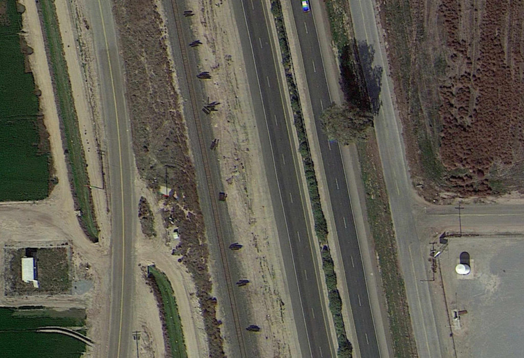
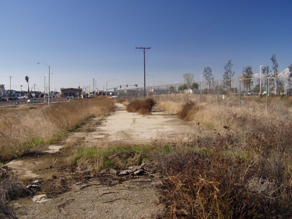
Looking west toward the Pepper Ave

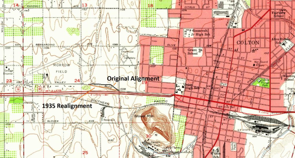
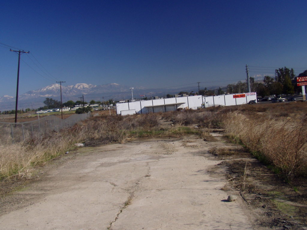
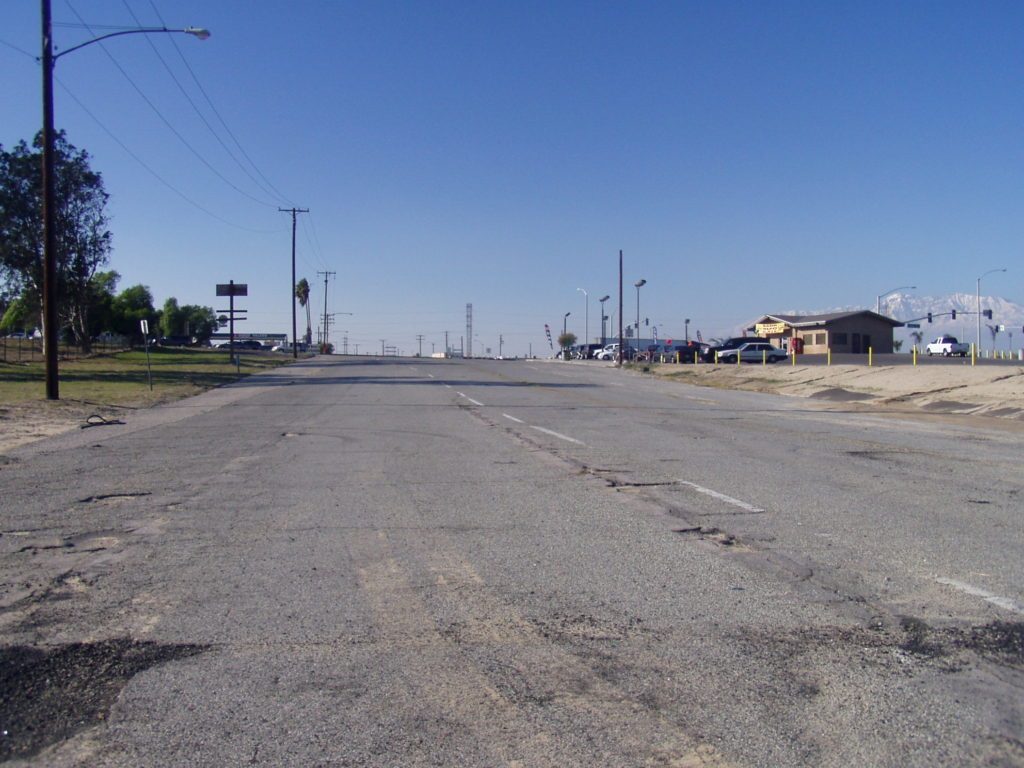
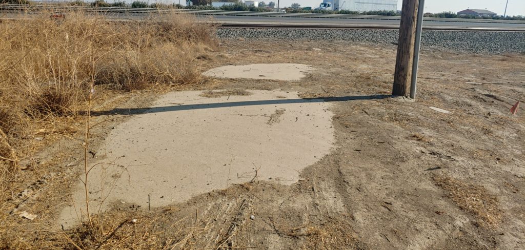
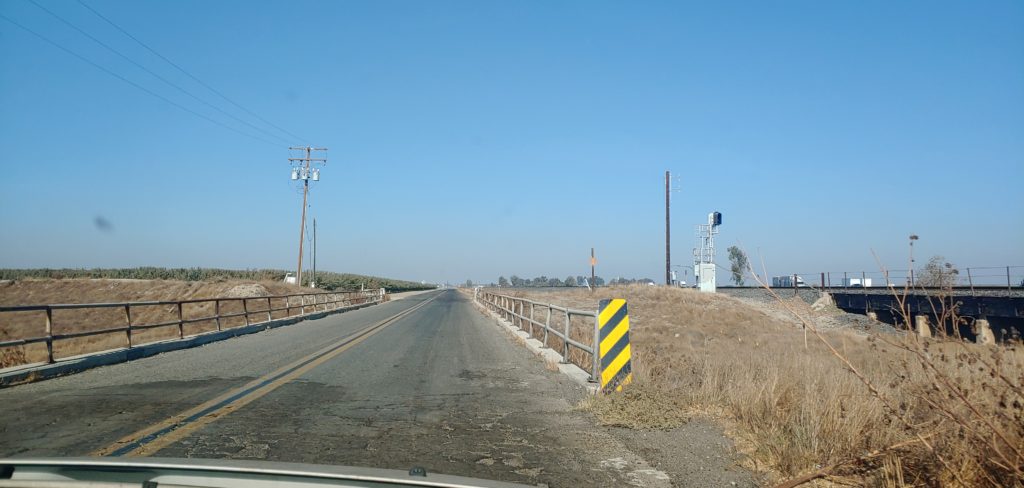
A small section of original paving, dating to the late 1910’s is still visible near the intersection of Valley Blvd and Pepper Ave. This section of US 99 was realigned in 1935 to create a gentler curve along with a wider roadway. Little remains of the original paving of US 99 through the Los Angeles area, so this is a special section. In 2008, Valley Blvd was realigned again to the north, obliterating a section of the paving.
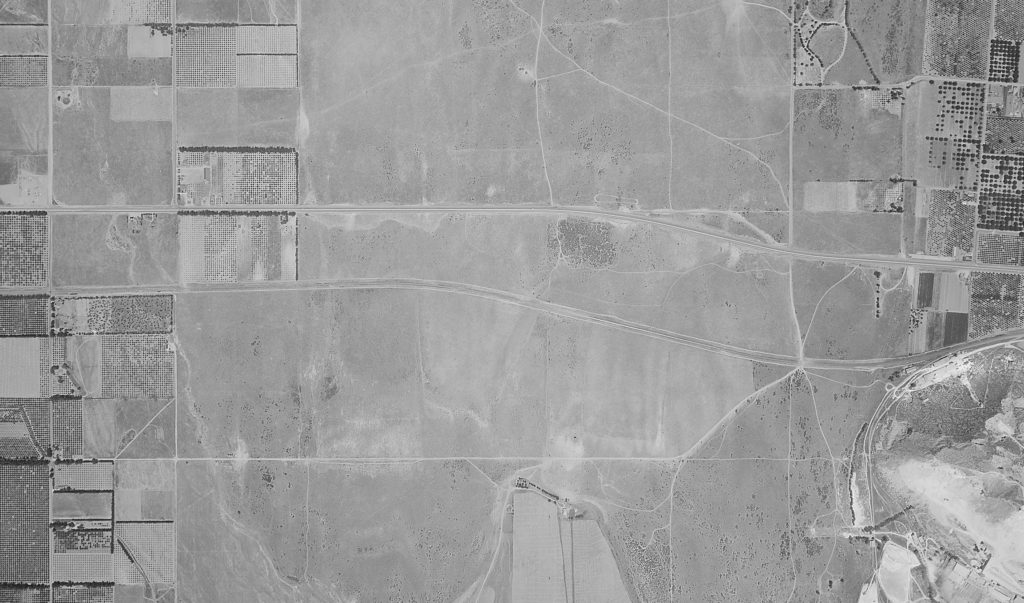
Aerial view from 1939 showing the recently realigned Valley Blvd between Pepper Ave and Meridian Ave. Courtesy UCSB
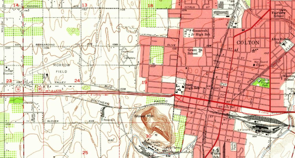
1953 USGS map showing the area. Meridian Ave is at center.
1953 map marked showing the different alignments.
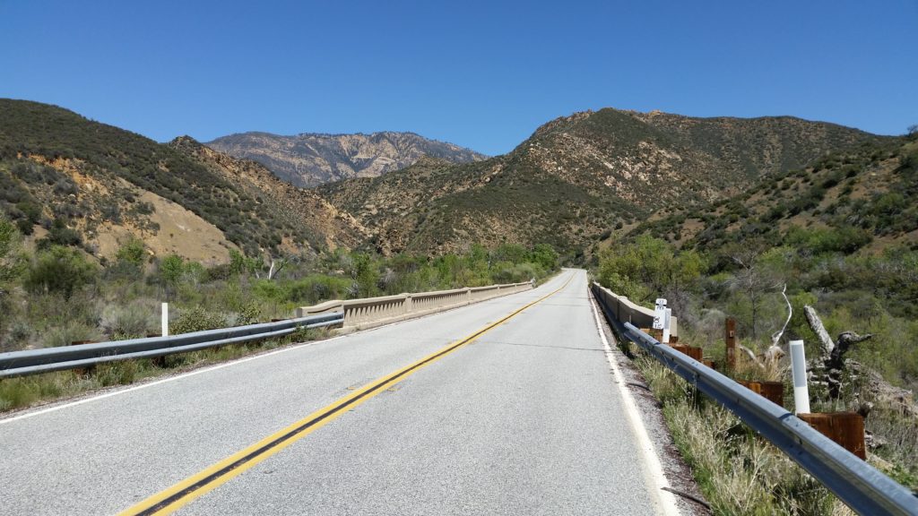
Looking east toward San Gorgonio Mountain
Old Valley Blvd looking west toward Pepper Ave
1935 concrete exposed under old Valley Blvd

September Meeting

Join Michael F Ballard and the Historic Highway 99 Association of California for a presentation on the history of US 99 and the Newhall Pass on September 14, 2021 at 6pm via Zoom. The history of the roadway will be covered from the Newhall Tunnel in 1910 to the HOV ramp at the I-5 / State 14 interchange in 2012. Q&A to follow the presentation. Please register using the link below.

https://us06web.zoom.us/meeting/register/tZcrc–rpzIoGdxQYOYkViOpSZQHqw2rEpl1

Featured Website

Jeremy M. Tuggle, born in Redding, is a descendant of 11 pioneer families who settled Shasta County between 1849-1889. Jeremy attended Shasta College and is the author of two published books, Rooted in Shasta County (2003), and A Journey Through Time: Ono and the Bald Hills (2008), as well as various articles on local history. In 2017, Tuggle was awarded a Community Service Award, a prestigious national award for community service in historic preservation, by the Major Pierson B. Reading Chapter of the National Society of the Daughters of the American Revolution. Jeremy is a member of the General Society of Mayflower Descendants in the State of California, and an Eagle Scout.

Tuggle has been employed at the Shasta Historical Society since November of 2009. In his present role as Education & Community Engagement Manager, Jeremy conducts research for the historical society’s programs and events, contributes to the Society’s social media presence, and ensures the highest quality guest and patron experience at the Society’s programs and community events and is available to community organizations to present programs about Shasta County history.

You can follow Jeremy Tuggle at:

https://exploringshastahistory.blogspot.com/

https://www.youtube.com/channel/UCWaOOvqGzR_kkhhgPI5cPRA

Facebook, Instagram, Twitter and Pinterest.

Book of the Month

My name is Mike Herman and I would like to thank Michael Ballard for inviting me to send an article on a book that I have written. 

In 2018, I started the Historic Ukiah-Tahoe Highway Assoc in an attempt to inform more people about the history and importance of this 222 mile Historic Highway running from Ukiah to Lake Tahoe. As part of this process, I wrote the Historic Ukiah-Tahoe Highway Travel Guide. 

During the research of this project, I discovered another “Forgotten Highway”. In Williams, the Ukiah-Tahoe Highway crosses Old US 99W. After I finished the first Travel Guide, I started another one for Historic US 99W. I am sure that most of you know that US 99 splits into an east and west routes between Sacramento and Red Bluff. US 99W went through the small towns on the west side of the Sacramento Valley. US 99W was replaced in I-5 and is no longer a state or federal highway. Nearly every town along the way has an interesting story or a point of interest that people driving down I-5 will never know. 

I provided Michael with an electronic copy of this Travel Guide that any member is welcome to use. If you would like to see the other Books and Travel Guides that we have, visit www.HistoricUSHighways.com

Featured Photo

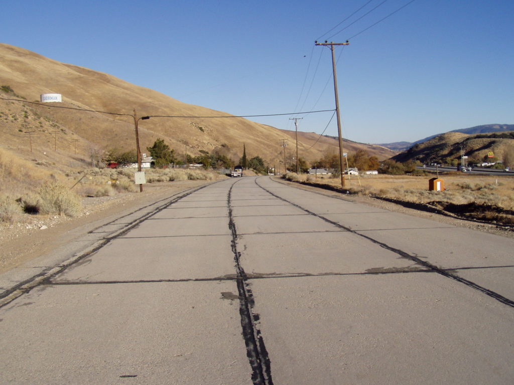
Three-lane US 99 in Gorman, CA

This section of US 99 in Gorman, California was the last section of the original 1933 Ridge Route Alternate concrete. It was resurfaced in 2010 by Los Angeles County. The concrete was poured on June 8, 1933. It remained a part of US 99 until 1951, when Gorman was bypassed by a new four-lane alignment along what is now the I-5 freeway. Few sections of original three-lane concrete remain these days. Only two exist in Southern California now and both are on US 101 (Carpinteria and Mission Viejo). Always make sure to get your photos while you can. You never know when things might go away or be covered up.

Errata

Starting January 2022, this newsletter will shift to bi-monthly publication. Interim updates and 99 alerts will still be given outside of that schedule.

September 2021 Presentation

Join Michael F Ballard and the Historic Highway 99 Association of California for a presentation on the history of US 99 and the Newhall Pass on September 14, 2021 at 6pm via Zoom. The history of the roadway will be covered from the Newhall Tunnel in 1910 to the HOV ramp at the I-5 / State 14 interchange in 2012. Q&A to follow the presentation. Please register using the link below.

https://us06web.zoom.us/meeting/register/tZcrc–rpzIoGdxQYOYkViOpSZQHqw2rEpl1

August 2021 Newsletter

Original US 99 – Tipton to Tulare

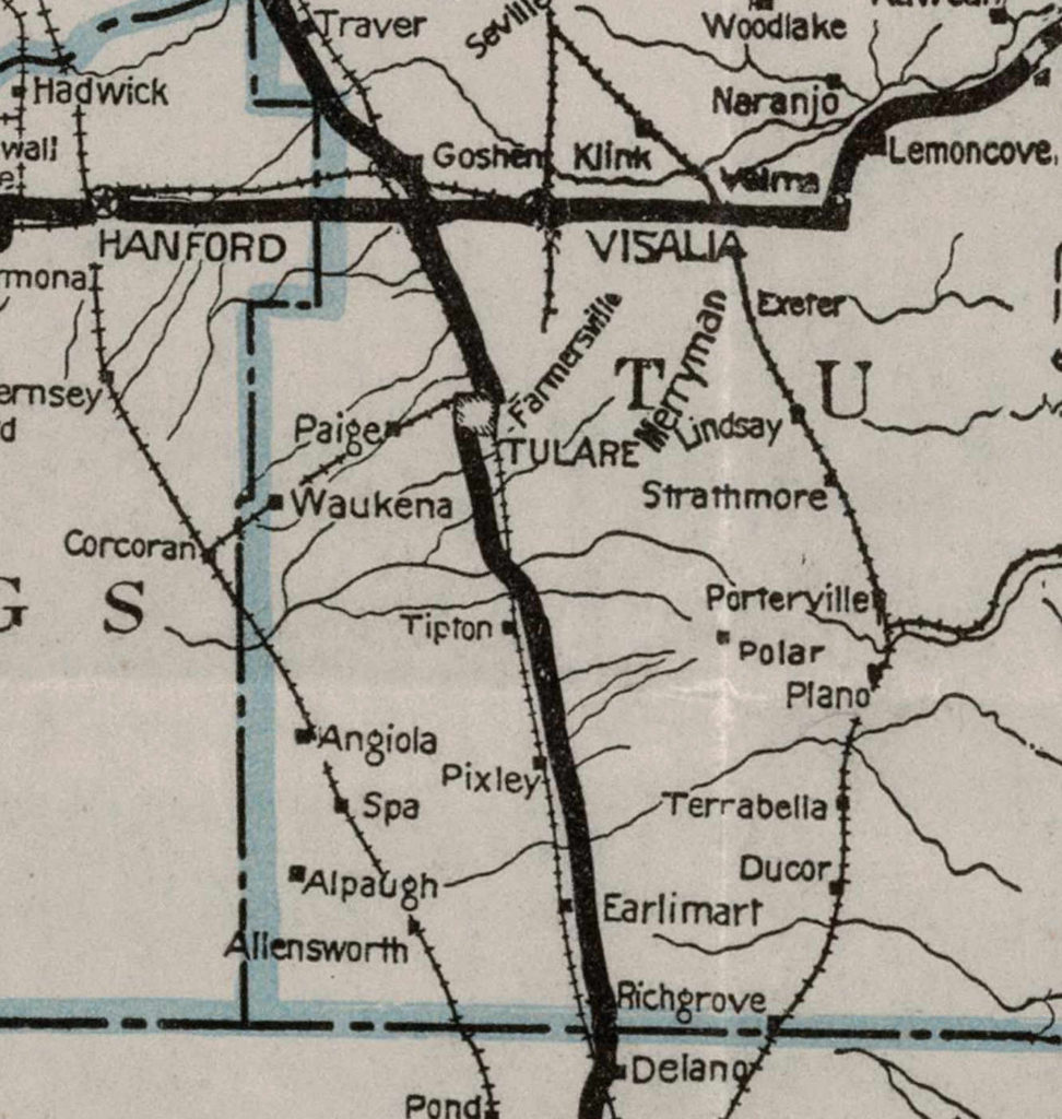
I found an original section of US 99 from Tipton to Tulare that has quite a few interesting features. It had been a while since I looked at maps of this section, as most of my research has concentrated between Los Angeles and Bakersfield. The map below shows the alignment of US 99 in 1926.

Portion of 1926 California Division of Highways map showing the original alignment of US 99. Courtesy – Caltrans

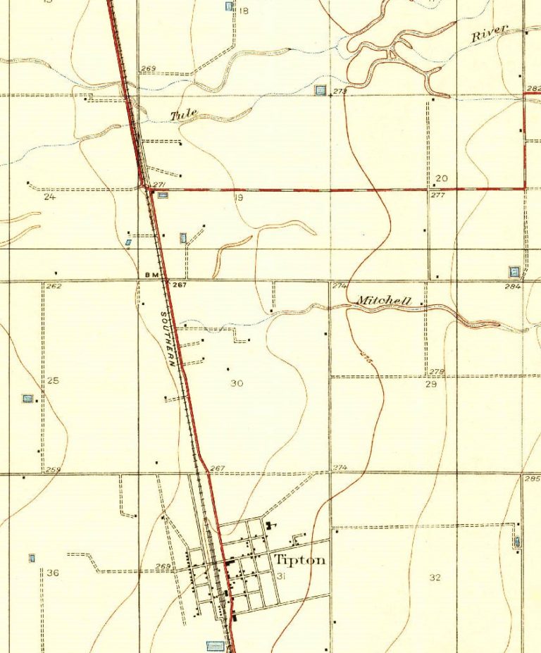
Until 1931, US 99, and by extension Legislative Route 4, went on the west side of the Southern Pacific tracks from current Ave 164 north of Tipton to Bardsley Ave in Tulare, following Tulare County Road 112. This section was most likely paved with a 20′ concrete slab around 1917.

Portion of a 1928 USGS map showing the original alignment and crossing
Aerial photograph showing the old railroad crossing. Courtesy – Google Earth
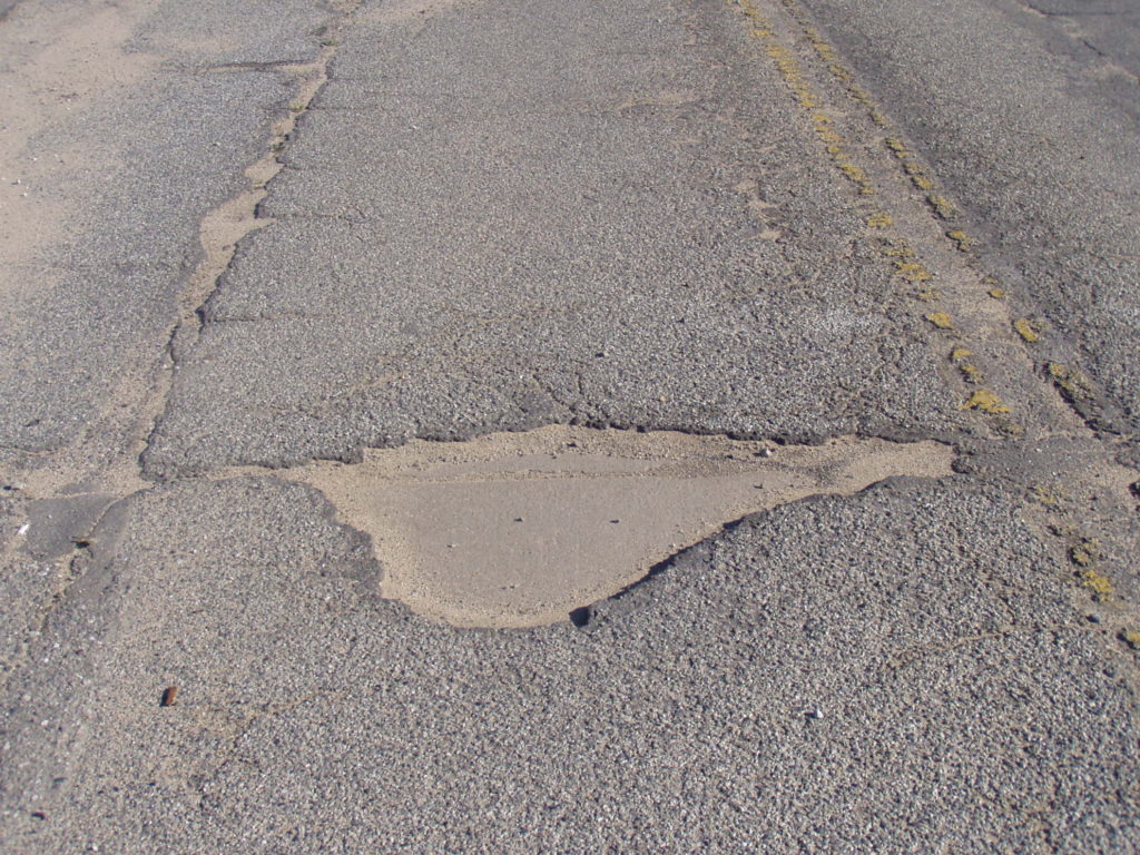
Original 1917 paving still intact at the railroad crossing

The roadway also retains four original bridges.  The two North Branch Tule River bridges (46C-0004 and 46C-0010 respectively) are from 1917 and retain their original pipe railing. Two other bridges, Elk Bayou and Bates Slough are also original, with the former dating to 1916. The telltale cracking of asphalt over concrete is also visible near the northern North Branch Tule River bridge to near Ave 184 at Octol.

South Branch Tule River (46C-0004) from 1917

The realignment in 1931 eliminated two railroad crossings without the use of bridges at the tracks. The new road was also built a little higher to help ease flooding problems that were common in the Central Valley. Today, some of the bridges built at that time still remain, albeit widened or otherwise modified. In time, we would like to work with Tulare County to get this section of Historic US 99 signed again.

August Meeting

On August 3, 2021 at 6 pm, we will have our first guest speaker. Please join Historian Evan Decker; President of Mentryville, California Inc for a presentation and Q & A on the History of Mentryville, California on August 3rd at 6pm; Hosted by the Historic Highway 99 Association. Mentryville is a historic ghost town known as the site of the “birthplace” of the Oil Industry in California in 1876 with the drilling of California Star Oil No. 4. Q & A to follow.

Register for the meeting using the link below:

https://zoom.us/meeting/register/tJMkd-2hqDoqEty9IHOFgyUWO0ns2_ZKrq_7

For more information:

https://www.mentryvillecalifornia1876.com/

Lake Shasta Water Level Monitoring

As the drought worsens here in California, reservoir levels are continuing to drop. In the case of Lake Shasta, a long section of the original alignment of US 99 is normally submerged below tens of feet of water. This year, the level is expected to get extremely low. Most of US 99 will be fully exposed when the lake hits 900 feet (167 feet below full pool) which is likely sometime this month. You can also follow our Twitter account (@Historic99) to get weekly (Sunday morning) updates.

https://cdec.water.ca.gov/dynamicapp/QueryDaily?s=SHA

Membership and Support

Our membership now extends across all three states US 99 traversed and British Columbia. It seems the word is slowly getting out there. We want to do more, however, and need your support. If you’re not a member already, sign up! Your membership is tax-deductible and your membership fees will go to helping us bring Historic Highway 99 into the spotlight it deserves.

We also still need your help. We are developing brochures and flyers for the Association for distribution. We will need your help with design as well as helping represent the Association throughout California. We’re also looking for ideas for fundraisers and outreach programs. If you’d like to help, contact us! We want to see this Association succeed and it cannot without help from all over.

We do wish to thank all those that have donated so far and signed up for memberships. Your contributions, regardless of size, have been very helpful to our cause.

Sign Design Contest

Interested in helping design a new sign for 99?

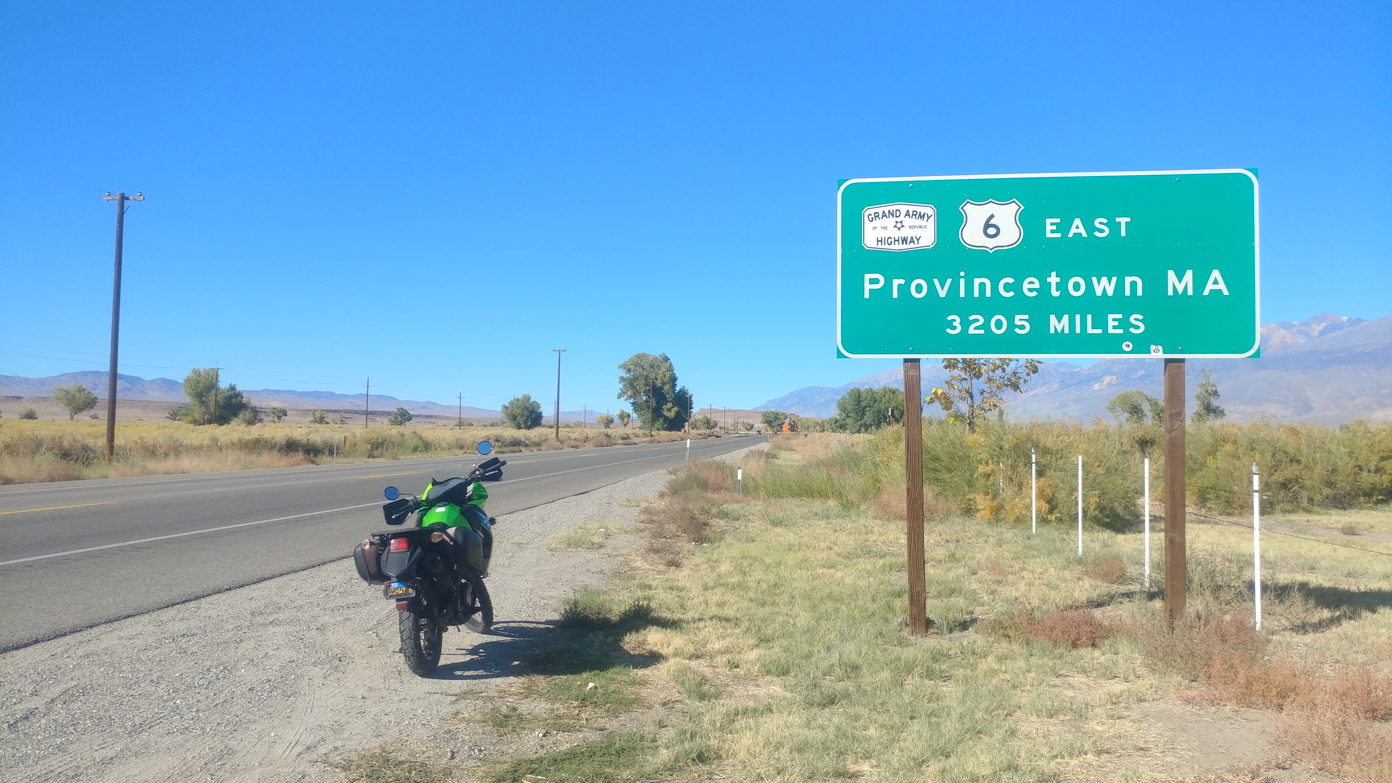
We are holding a design contest for a new terminus mileage sign for US 99. US 6 has one in Bishop. US 50 has one in Sacramento. I-40 has one in Barstow. US 99 does not and we intend to change that. Two signs will be placed, one in Calexico, California and the other in Blaine, Washington to commemorate the historic termini of US 99. What we are looking for is a sign that stands out among the others and gives the mileage to each end. For reference, the historic mileage of US 99 was 1499 miles in 1958 per AAA. The sign should contain a US 99 shield, possibly three for each of the states it passed through. We aren’t looking for a large sign as there may be space constraints but certainly a sign 24″ x 36″ or smaller, horizontal or vertical, would be acceptable. At the present time, we are not certain as to when the signs will be posted. All designs must be submitted by August 15, 2021.

The winner will be announced in our September newsletter.

Featured Book

Freewaytopia: How Freeways Shaped Los Angeles” explores how social, economic, political, and cultural demands created the web of expressways whose very form―futuristic, majestic, and progressive―perfectly exemplifies the City of Angels. From the Arroyo Seco, which began construction during the Great Depression, to the Simi Valley and Century Freeways, which were completed in 1993, author Paul Haddad provides an entertaining and engaging history of the 527 miles of road that comprise the Los Angeles freeway system.

Each of Los Angeles’s twelve freeways receives its own chapter, and these are supplemented by “Off-Ramps”―sidebars that dish out pithy factoids about Botts’ Dots, SigAlerts, and all matter of freeway lexicon, such as why Southern Californians are the only people in the country who place the word “the” in front of their interstates, as in “the 5,” or “the 101.”

Freewaytopia also explores those routes that never saw the light of day. Imagine superhighways burrowing through Laurel Canyon, tunneling under the Hollywood Sign, or spanning the waters of Santa Monica Bay. With a few more legislative strokes of the pen, you wouldn’t have to imagine them―they’d already exist.

Haddad notably gives voice to those individuals whose lives were inextricably connected―for better or worse―to the city’s freeways: The hundreds of thousands of mostly minority and lower-class residents who protested against their displacement as a result of eminent domain. Women engineers who excelled in a man’s field. Elected officials who helped further freeways . . . or stop them dead in their tracks. And he pays tribute to the corps of civic and state highway employees whose collective vision, expertise, and dedication created not just the most famous freeway network in the world, but feats of engineering that, at their best, achieve architectural poetry.

Finally, let’s not forget the beauty queens―no freeway in Los Angeles ever opened without their royal presence.

Featured Image

Former US 399 (now State 33) in Sespe Gorge at the 1932 Sespe Creek Bridge (52-0078). Courtesy – Michael F Ballard

Errata

Would you like to write an article for our newsletter? Contact us for details.

August 2021 Presentation

On August 3, 2021 at 6 pm, we will have our first guest speaker. Please join Historian Evan Decker; President of Mentryville, California Inc for a presentation and Q & A on the History of Mentryville, California on August 3rd at 6pm; Hosted by the Historic Highway 99 Association. Mentryville is a historic ghost town known as the site of the “birthplace” of the Oil Industry in California in 1876 with the drilling of California Star Oil No. 4. Q & A to follow.

Register using the link below:

https://zoom.us/meeting/register/tJMkd-2hqDoqEty9IHOFgyUWO0ns2_ZKrq_7

For more information:

https://www.mentryvillecalifornia1876.com/

July 2021 Newsletter

The Grapevine or The Ridge Route?

Grapevine Canyon and Dead Man’s Curve. Courtesy – Michael F Ballard

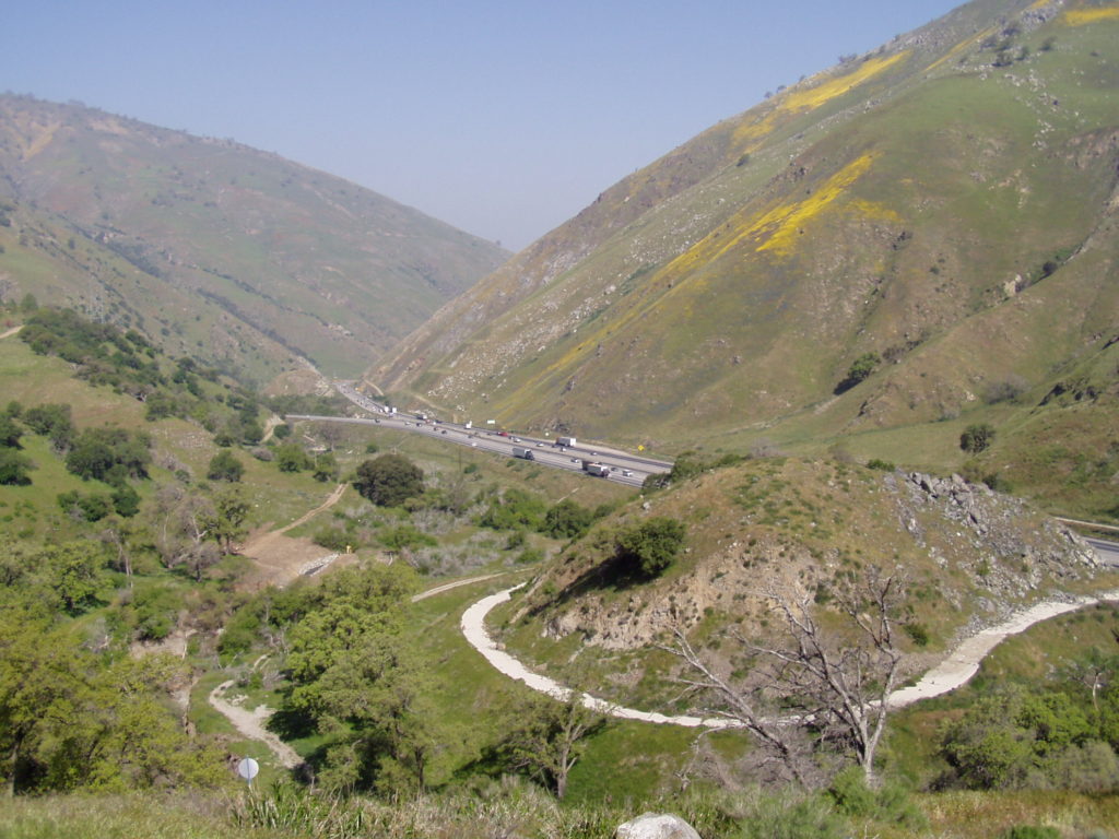
I-5 is commonly referred to as “The Grapevine” by locals and traffic reporters. Most assume the name derives from the twisty nature of the original roadway – the Ridge Route. That road was indeed very twisty, much like a grapevine. However, that is still not the reason. The name Grapevine actually comes from Grapevine Canyon, where old US 99 and I-5 come down from the mountains and into the San Joaquin Valley. The canyon is called such as wild grapes grow along the canyon walls. It was formerly known as Canada De Las Uvas which is Spanish for Canyon of the Grapes. The name Tejon Pass is also a “new” addition to the area. The current Tejon Pass was known as Grapevine Pass or Badger Pass until the 1850’s. Old Tejon Pass, much farther to the east, was a very treacherous route. That pass was eventually abandoned in favor of the current Tejon Pass. The name was just shifted to the new route.

After the 1933 bypass of the original road to as late as the 1970’s, the roadway over the mountains was still referred to as “The Ridge Route”. It wasn’t until sometime in the 1980’s that the name “The Grapevine” was extended to the entire roadway. Why this was done is still unclear. Even Caltrans called it the “Ridge Route” when I-5 was completed. So, if you want to call it proper – call it Tejon Pass, when being specific to the actual pass, and the Ridge Route when referring to I-5 from Castaic to Grapevine. While you’re passing through Grapevine Canyon, be sure to spot the wild grapevines that still grow in the canyon. Names may change, but the name Ridge Route should live on. It applies to I-5 better than “The Grapevine” ever will.

What do you think? Tell us your thoughts in the comments below.

99 Alert – Mammoth Orange in Fairmead

The Fossil Discovery Museum near Chowchilla, California needs your help. They are in the process of restoring the former Mammoth Orange that was cited along Highway 99 at Fairmead until freeway construction closed off its access in 2007. The last operating Giant, or Mammoth Orange stand along old 99 was rescued and will be reopened nearby. The museum is raising funds for this effort. They can use your support! Lets help bring back a piece of Highway 99 history. Make sure to tell them the Highway 99 Association sent you!

Their website:

https://www.maderamammoths.org/projects.html

Link to their fundraiser:

https://www.gofundme.com/f/mammothorange

Events

Our monthly meetings and presentations have been a success and will continue to grow. In the future, we will have member-only presentations, so make sure you sign up for a membership today! Your tax-deductible donations help us continue to keep Highway 99 alive.

On July 6, 2021 at 6 pm, we will have a presentation on the history of US 99 through the San Gorgonio Pass by Michael Ballard. The presentation will include maps, photos, and detailed information about the roadway from Calimesa to Edom, near Thousand Palms.

https://zoom.us/meeting/register/tJEqd-moqj4vHdJw6RL5SEOPiOfdgV2J3M4G

In August, we will have our first guest speaker. So, join Historian Evan Decker; President of Mentryville, California Inc for a presentation and Q & A on the History of Mentryville, California on August 3rd at 6pm; Hosted by the Historic Highway 99 Association. Mentryville is a historic ghost town known as the site of the “birthplace” of the Oil Industry in California in 1876 with the drilling of California Star Oil No. 4. Q & A to follow.

https://zoom.us/meeting/register/tJMkd-2hqDoqEty9IHOFgyUWO0ns2_ZKrq_7

YouTube Channel

We now have a YouTube channel, which we plan to use to post videos of any events, points of interest along 99, meetings, presentations, and much more. Come check it out!

https://www.youtube.com/channel/UCAvGZpwJjMnoBplxbkxMmaw

Highway 99 Online Calendar

We started a new calendar for Highway 99 Association events and any other Highway 99 related events. We are looking to fill it in! If you’d like to add your event or have one in mind to add, let us know!

Membership and Outreach

Our membership now extends across all three states US 99 traversed and British Columbia. It seems the word is slowly getting out there. We want to do more, however, and need your support. If you’re not a member already, sign up! Your membership is tax-deductible and your membership fees will go to helping us bring Historic Highway 99 into the spotlight it deserves.

We also need your help. Soon, we will develop brochures and flyers for the Association for distribution. We will need your help in doing this as well as helping represent the Association throughout California. We’re also looking for ideas for fundraisers and outreach programs. If you’d like to help, contact us! We want to see this Association succeed and it cannot without help from all over.

We do wish to thank all those that have donated so far and signed up for memberships. Your contributions, regardless of size, have been very helpful to our cause.

Sign Design Contest

Mileage sign on US 6 in Bishop, California

Interested in helping design a new sign for 99?

We are holding a design contest for a new terminus mileage sign for US 99. US 6 has one in Bishop. US 50 has one in Sacramento. I-40 has one in Barstow. US 99 does not and we intend to change that. Two signs will be placed, one in Calexico, California and the other in Blaine, Washington to commemorate the historic termini of US 99. What we are looking for is a sign that stands out among the others and gives the mileage to each end. For reference, the historic mileage of US 99 was 1499 miles in 1958 per AAA. The sign should contain a US 99 shield, possibly three for each of the states it passed through. We aren’t looking for a large sign as there may be space constraints but certainly a sign 24″ x 36″ or smaller, horizontal or vertical, would be acceptable. At the present time, we are not certain as to when the signs will be posted. All designs must be submitted by August 15, 2021.

The winner will be announced in our September newsletter.

Featured Image

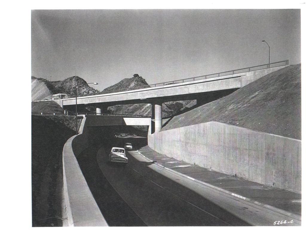
US 6 / US 99 Interchange on December 28, 1956. Courtesy – Caltrans

Newhall Pass has been a congestion point for centuries. It is one of the three passes that lead to central California from the Los Angeles area. Until cuts were made in the summit, beginning in 1854 and culminating in Beale’s Cut in 1863, the pass was nearly insurmountable by wagons. In 1910, the cut was bypassed by a narrow tunnel, which itself was replaced by a much larger cut in 1939. US 99 itself bypassed the old pass in 1930, following a new route through Weldon and Gavin Canyons along the “Newhall Alternate”. Tunnel Station, where Sierra Highway and US 99 met, was again a point of congestion. In 1953, construction on a new freeway, complete with direct connector ramps, began in the pass. It would be the first section of freeway for US 99 in the area. In 1955, it was completed removing the congestion point at Tunnel Station with a direct ramp from WB US 6 to SB US 99.

Today, the original three-level interchange remains but with only two levels still in use. The lower ramp is now partially filled in, having been replaced with the newer I-5 / State 14 interchange in 1975. Newhall Pass today remains a very busy and vital corridor for Southern California.